

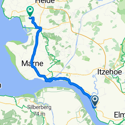
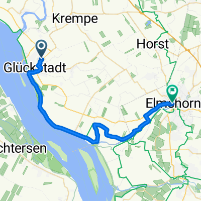
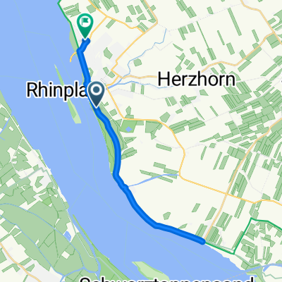
20160504_172719.gpx
A cycling route starting in Glückstadt, Schleswig-Holstein, Germany.
Overview
About this route
TEASI track
- -:--
- Duration
- 38.4 km
- Distance
- 0 m
- Ascent
- 0 m
- Descent
- ---
- Avg. speed
- ---
- Max. altitude

Route quality
Waytypes & surfaces along the route
Waytypes
Road
10 km
(26 %)
Quiet road
7.7 km
(20 %)
Surfaces
Paved
34.6 km
(90 %)
Asphalt
33.8 km
(88 %)
Paved (undefined)
0.8 km
(2 %)
Undefined
3.8 km
(10 %)
Continue with Bikemap
Use, edit, or download this cycling route
You would like to ride 20160504_172719.gpx or customize it for your own trip? Here is what you can do with this Bikemap route:
Free features
- Save this route as favorite or in collections
- Copy & plan your own version of this route
- Sync your route with Garmin or Wahoo
Premium features
Free trial for 3 days, or one-time payment. More about Bikemap Premium.
- Navigate this route on iOS & Android
- Export a GPX / KML file of this route
- Create your custom printout (try it for free)
- Download this route for offline navigation
Discover more Premium features.
Get Bikemap PremiumFrom our community
Other popular routes starting in Glückstadt
 Am Markt, Glückstadt to 4. Querweg, Nordermeldorf
- Distance
- 66.7 km
- Ascent
- 10 m
- Descent
- 13 m
- Location
- Glückstadt, Schleswig-Holstein, Germany
 Schleuer, Glückstadt to Große Deichstraße, Glückstadt
- Distance
- 9.9 km
- Ascent
- 9 m
- Descent
- 14 m
- Location
- Glückstadt, Schleswig-Holstein, Germany
 HB-HH E4
- Distance
- 37.7 km
- Ascent
- 31 m
- Descent
- 22 m
- Location
- Glückstadt, Schleswig-Holstein, Germany
 Bohnstraße 18C, Glückstadt nach Am Freizeitbad, Brunsbüttel
- Distance
- 27.4 km
- Ascent
- 78 m
- Descent
- 81 m
- Location
- Glückstadt, Schleswig-Holstein, Germany
 Büttel - Husum
- Distance
- 129.6 km
- Ascent
- 98 m
- Descent
- 99 m
- Location
- Glückstadt, Schleswig-Holstein, Germany
 Anna-Tiessen-Straße nach Alter Markt
- Distance
- 28.9 km
- Ascent
- 44 m
- Descent
- 77 m
- Location
- Glückstadt, Schleswig-Holstein, Germany
 Molenkiekergang, Glückstadt to Koogstraße, Brunsbüttel
- Distance
- 30 km
- Ascent
- 49 m
- Descent
- 48 m
- Location
- Glückstadt, Schleswig-Holstein, Germany
 Europäischer Fernwanderweg 9, Glückstadt nach Bauernpriel, Glückstadt
- Distance
- 20 km
- Ascent
- 10 m
- Descent
- 13 m
- Location
- Glückstadt, Schleswig-Holstein, Germany
Open it in the app