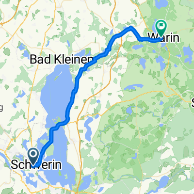
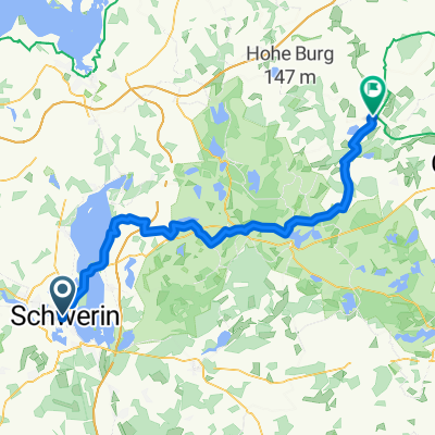
Schwerin - Sternberger Seenlandschaft
A cycling route starting in Schwerin, Mecklenburg-Vorpommern, Germany.
Overview
About this route
Schwerin - Cambs - vor Ventschow nach Warin - Warin - Qualitz - Rühn - Lohmen - Dobbertin - Dabel - Warmkow - Demen - Venzkow - Crivitz - B 321 - Schwerin Franzosenweg
- -:--
- Duration
- 140.4 km
- Distance
- 317 m
- Ascent
- 317 m
- Descent
- ---
- Avg. speed
- ---
- Max. altitude
Route quality
Waytypes & surfaces along the route
Waytypes
Road
18.3 km
(13 %)
Quiet road
15.4 km
(11 %)
Surfaces
Paved
84.3 km
(60 %)
Asphalt
82.9 km
(59 %)
Paved (undefined)
1.4 km
(1 %)
Undefined
56.2 km
(40 %)
Continue with Bikemap
Use, edit, or download this cycling route
You would like to ride Schwerin - Sternberger Seenlandschaft or customize it for your own trip? Here is what you can do with this Bikemap route:
Free features
- Save this route as favorite or in collections
- Copy & plan your own version of this route
- Split it into stages to create a multi-day tour
- Sync your route with Garmin or Wahoo
Premium features
Free trial for 3 days, or one-time payment. More about Bikemap Premium.
- Navigate this route on iOS & Android
- Export a GPX / KML file of this route
- Create your custom printout (try it for free)
- Download this route for offline navigation
Discover more Premium features.
Get Bikemap PremiumFrom our community
Other popular routes starting in Schwerin
- 13. Schwerin - Warin
- Distance
- 34.5 km
- Ascent
- 113 m
- Descent
- 150 m
- Location
- Schwerin, Mecklenburg-Vorpommern, Germany
- Schweriner See 60 KM Aussensee
- Distance
- 60.1 km
- Ascent
- 140 m
- Descent
- 141 m
- Location
- Schwerin, Mecklenburg-Vorpommern, Germany
- Mecklenburgstraße 47, Schwerin nach Lindenstraße 37, Krakow
- Distance
- 67.2 km
- Ascent
- 446 m
- Descent
- 432 m
- Location
- Schwerin, Mecklenburg-Vorpommern, Germany
- Alexandrinenstraße 1, Schwerin nach Wismarsche Straße 139, Schwerin
- Distance
- 57.8 km
- Ascent
- 314 m
- Descent
- 314 m
- Location
- Schwerin, Mecklenburg-Vorpommern, Germany
- Schwerin und östlich von Schwerin
- Distance
- 81 km
- Ascent
- 263 m
- Descent
- 264 m
- Location
- Schwerin, Mecklenburg-Vorpommern, Germany
- Arsenalstraße 14, Schwerin nach Wiligrader Straße 3, Lübstorf
- Distance
- 16.5 km
- Ascent
- 135 m
- Descent
- 108 m
- Location
- Schwerin, Mecklenburg-Vorpommern, Germany
- 31 Um den Schweriner See
- Distance
- 31.4 km
- Ascent
- 126 m
- Descent
- 126 m
- Location
- Schwerin, Mecklenburg-Vorpommern, Germany
- Ae. SN-Innen-See, Zülow,u.Mueßer Berg
- Distance
- 34.2 km
- Ascent
- 148 m
- Descent
- 147 m
- Location
- Schwerin, Mecklenburg-Vorpommern, Germany
Open it in the app