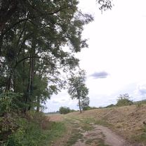
Kurim a spat
A cycling route starting in Brno, South Moravian, Czechia.
Overview
About this route
Vacsinou rovinka, mierne kopceky
- -:--
- Duration
- 29.5 km
- Distance
- 229 m
- Ascent
- 228 m
- Descent
- ---
- Avg. speed
- ---
- Max. altitude
Route quality
Waytypes & surfaces along the route
Waytypes
Road
19.5 km
(66 %)
Quiet road
4.1 km
(14 %)
Surfaces
Paved
28 km
(95 %)
Asphalt
27.7 km
(94 %)
Concrete
0.3 km
(1 %)
Undefined
1.5 km
(5 %)
Continue with Bikemap
Use, edit, or download this cycling route
You would like to ride Kurim a spat or customize it for your own trip? Here is what you can do with this Bikemap route:
Free features
- Save this route as favorite or in collections
- Copy & plan your own version of this route
- Sync your route with Garmin or Wahoo
Premium features
Free trial for 3 days, or one-time payment. More about Bikemap Premium.
- Navigate this route on iOS & Android
- Export a GPX / KML file of this route
- Create your custom printout (try it for free)
- Download this route for offline navigation
Discover more Premium features.
Get Bikemap PremiumFrom our community
Other popular routes starting in Brno
 Lužánky - Holubice - Šaratice - Sokolnice - Lužánky
- Distance
- 49.4 km
- Ascent
- 249 m
- Descent
- 258 m
- Location
- Brno, South Moravian, Czechia
 Židenice - Šumbera - Ochoz - Mariánské údolí - Židenice
- Distance
- 30.6 km
- Ascent
- 365 m
- Descent
- 365 m
- Location
- Brno, South Moravian, Czechia
 Křtiny - max nastoupaných metrů na krátkou vzdálenost
- Distance
- 64.8 km
- Ascent
- 1,524 m
- Descent
- 1,424 m
- Location
- Brno, South Moravian, Czechia
 Wien - Brünn - Prag - Dresden über Tsch. Radweg 4 und 1
- Distance
- 434.6 km
- Ascent
- 1,381 m
- Descent
- 1,475 m
- Location
- Brno, South Moravian, Czechia
 Brno-Lomnice a zpet
- Distance
- 75.3 km
- Ascent
- 729 m
- Descent
- 729 m
- Location
- Brno, South Moravian, Czechia
 Lomená 36B do Lomená 36B
- Distance
- 17 km
- Ascent
- 40 m
- Descent
- 84 m
- Location
- Brno, South Moravian, Czechia
 Svratecká stezka Pisárky- Bystrc(přístaviště)
- Distance
- 7.4 km
- Ascent
- 70 m
- Descent
- 48 m
- Location
- Brno, South Moravian, Czechia
 Lomená-Rebešky-Rajhrad-Židlochovice a Zpět
- Distance
- 39.5 km
- Ascent
- 71 m
- Descent
- 117 m
- Location
- Brno, South Moravian, Czechia
Open it in the app


