

Fluggaenkoecchicebolsen
A cycling route starting in Szklarska Poręba, Lower Silesian Voivodeship, Poland.
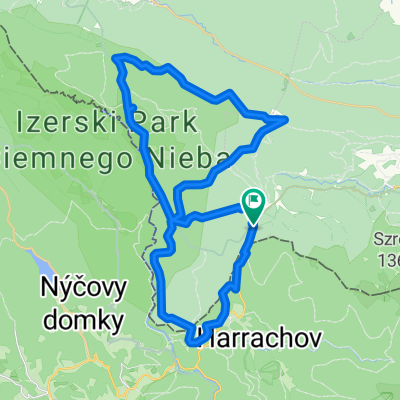
Overview
About this route
26-29 May 2016
- -:--
- Duration
- 295.1 km
- Distance
- 535 m
- Ascent
- 1,069 m
- Descent
- ---
- Avg. speed
- ---
- Max. altitude

Route quality
Waytypes & surfaces along the route
Waytypes
Quiet road
91.5 km
(31 %)
Road
56.1 km
(19 %)
Surfaces
Paved
197.7 km
(67 %)
Unpaved
29.5 km
(10 %)
Asphalt
188.9 km
(64 %)
Gravel
20.7 km
(7 %)
Route highlights
Points of interest along the route

Point of interest after 94.4 km
Trójstyk polsko-czesko-niemiecki

Point of interest after 166.4 km
Bautzen - Budziszyn

Point of interest after 236.8 km
Rakotzbrucke
Continue with Bikemap
Use, edit, or download this cycling route
You would like to ride Fluggaenkoecchicebolsen or customize it for your own trip? Here is what you can do with this Bikemap route:
Free features
- Save this route as favorite or in collections
- Copy & plan your own version of this route
- Split it into stages to create a multi-day tour
- Sync your route with Garmin or Wahoo
Premium features
Free trial for 3 days, or one-time payment. More about Bikemap Premium.
- Navigate this route on iOS & Android
- Export a GPX / KML file of this route
- Create your custom printout (try it for free)
- Download this route for offline navigation
Discover more Premium features.
Get Bikemap PremiumFrom our community
Other popular routes starting in Szklarska Poręba
 Jakuszyce - Stóg Izerski
- Distance
- 39.3 km
- Ascent
- 731 m
- Descent
- 730 m
- Location
- Szklarska Poręba, Lower Silesian Voivodeship, Poland
 Jakuszyce
- Distance
- 40.1 km
- Ascent
- 677 m
- Descent
- 677 m
- Location
- Szklarska Poręba, Lower Silesian Voivodeship, Poland
 SZKLARSKA - Harrachov - k/ŚWIERADÓW - Szklarska
- Distance
- 91 km
- Ascent
- 1,288 m
- Descent
- 1,318 m
- Location
- Szklarska Poręba, Lower Silesian Voivodeship, Poland
 Jakuszyce-Cicha Równia-Kopalnia-Wysoka Kopa-Chatka Górzystów-Orle-Jakuszyce
- Distance
- 26.4 km
- Ascent
- 407 m
- Descent
- 407 m
- Location
- Szklarska Poręba, Lower Silesian Voivodeship, Poland
 Szklarska Poręba - Zwalisko - Przednia Kopa- Chatka Górzystów
- Distance
- 31.5 km
- Ascent
- 619 m
- Descent
- 618 m
- Location
- Szklarska Poręba, Lower Silesian Voivodeship, Poland
 SZKLARSKA - LIBEREC/Frydlant/Świeradów - Szklarska
- Distance
- 105.8 km
- Ascent
- 1,493 m
- Descent
- 1,462 m
- Location
- Szklarska Poręba, Lower Silesian Voivodeship, Poland
 Izery
Izery- Distance
- 38.9 km
- Ascent
- 633 m
- Descent
- 634 m
- Location
- Szklarska Poręba, Lower Silesian Voivodeship, Poland
 Izery - lite
- Distance
- 27.7 km
- Ascent
- 272 m
- Descent
- 272 m
- Location
- Szklarska Poręba, Lower Silesian Voivodeship, Poland
Open it in the app