

Nº 8 FONT DE LA SALUD – MAGDALENA.
A cycling route starting in Castellon, Valencia, Spain.
Overview
About this route
MOUNTAIN BIKE ROUTE.
IT WILL INCLUDE SOME TECHNICAL AND PHYSICAL CHALLENGES.
HIGHLIGHTED IS THE ASCENT ALONG THE PATH PARALLEL TO THE BARRANCO DE L'ALGEPSAR TO THE MASIA AND THE DESCENT THROUGH THE SAME BARRANCO (VERY TECHNICAL), AS WELL AS THE MAGDALENA CIRCULATION TRAIL.
ON THE RETURN, WE CAN CHOOSE THE BIKE LANE OR THE PARALLEL DIRT TRACK.
- -:--
- Duration
- 25.3 km
- Distance
- 340 m
- Ascent
- 340 m
- Descent
- ---
- Avg. speed
- 186 m
- Max. altitude
Route quality
Waytypes & surfaces along the route
Waytypes
Track
7.3 km
(29 %)
Quiet road
5.8 km
(23 %)
Surfaces
Paved
3.3 km
(13 %)
Unpaved
6.1 km
(24 %)
Unpaved (undefined)
2.8 km
(11 %)
Ground
2.5 km
(10 %)
Continue with Bikemap
Use, edit, or download this cycling route
You would like to ride Nº 8 FONT DE LA SALUD – MAGDALENA. or customize it for your own trip? Here is what you can do with this Bikemap route:
Free features
- Save this route as favorite or in collections
- Copy & plan your own version of this route
- Sync your route with Garmin or Wahoo
Premium features
Free trial for 3 days, or one-time payment. More about Bikemap Premium.
- Navigate this route on iOS & Android
- Export a GPX / KML file of this route
- Create your custom printout (try it for free)
- Download this route for offline navigation
Discover more Premium features.
Get Bikemap PremiumFrom our community
Other popular routes starting in Castellon
 Nº 8 FONT DE LA SALUD – MAGDALENA.
- Distance
- 25.3 km
- Ascent
- 340 m
- Descent
- 340 m
- Location
- Castellon, Valencia, Spain
 Castelló - Serra d'Orpesa - Castelló
- Distance
- 52.3 km
- Ascent
- 486 m
- Descent
- 486 m
- Location
- Castellon, Valencia, Spain
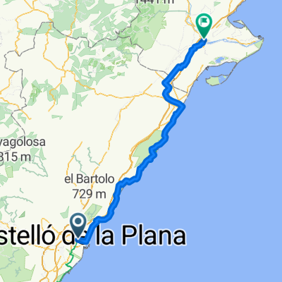 Castellon - Amposta
- Distance
- 132 km
- Ascent
- 797 m
- Descent
- 814 m
- Location
- Castellon, Valencia, Spain
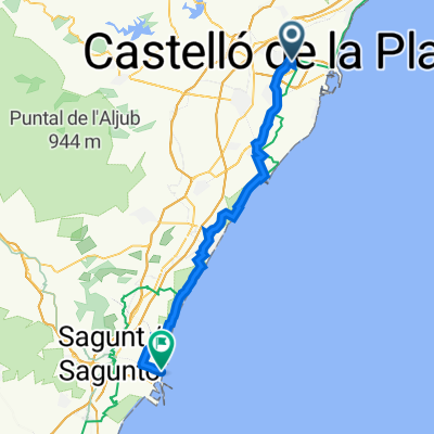 Castellón de la Plana nach Port de Sagunt
- Distance
- 49.4 km
- Ascent
- 72 m
- Descent
- 103 m
- Location
- Castellon, Valencia, Spain
 Nº 1 SANT ROC DE CANET - LLEDO.
- Distance
- 7.8 km
- Ascent
- 9 m
- Descent
- 17 m
- Location
- Castellon, Valencia, Spain
 Racó de Ramell, Castellón de la Plana a Pasaje de Prim, Castellón de la Plana
- Distance
- 25.8 km
- Ascent
- 422 m
- Descent
- 416 m
- Location
- Castellon, Valencia, Spain
 Nº 9 DIPOSIT VERD – EL COLLET.
- Distance
- 20.1 km
- Ascent
- 369 m
- Descent
- 372 m
- Location
- Castellon, Valencia, Spain
 Desierto de las Palmas desde Castellon
- Distance
- 53.2 km
- Ascent
- 803 m
- Descent
- 804 m
- Location
- Castellon, Valencia, Spain
Open it in the app