

Franky`s Rennradrunde Moers Büderich Alpen Moers
A cycling route starting in Kamp-Lintfort, North Rhine-Westphalia, Germany.
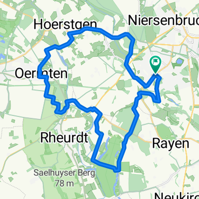
Overview
About this route
This route is very close to the trip towards Xanten, in Büderich you turn left before the ramp to the Rhine bridge towards Alpen. The traffic on this road is a bit annoying, but it pushes the road cyclist to perform at their best. From Alpen it becomes nicer and quieter again, through the fields near the Alpsray airfield it then goes back towards the home base. The title photo shows the push barge Veerhaven X climbing with 6 lights, it carries ore and coal so that we can go full throttle again at the Beekerwerth steelworks :-) .
- -:--
- Duration
- 47.1 km
- Distance
- 67 m
- Ascent
- 67 m
- Descent
- ---
- Avg. speed
- ---
- Max. altitude

Continue with Bikemap
Use, edit, or download this cycling route
You would like to ride Franky`s Rennradrunde Moers Büderich Alpen Moers or customize it for your own trip? Here is what you can do with this Bikemap route:
Free features
- Save this route as favorite or in collections
- Copy & plan your own version of this route
- Sync your route with Garmin or Wahoo
Premium features
Free trial for 3 days, or one-time payment. More about Bikemap Premium.
- Navigate this route on iOS & Android
- Export a GPX / KML file of this route
- Create your custom printout (try it for free)
- Download this route for offline navigation
Discover more Premium features.
Get Bikemap PremiumFrom our community
Other popular routes starting in Kamp-Lintfort
 Frankys Runde, Pattberg, Homberg,Essenberg, Kaßlerfeld, Walsum, Orsoy, Budberg, Pattberg
- Distance
- 52.5 km
- Ascent
- 124 m
- Descent
- 122 m
- Location
- Kamp-Lintfort, North Rhine-Westphalia, Germany
 Sakrale Bauten am Niederrhein
- Distance
- 63.5 km
- Ascent
- 124 m
- Descent
- 167 m
- Location
- Kamp-Lintfort, North Rhine-Westphalia, Germany
 Lintfort - Oermter Berg - Lintfort
- Distance
- 23.3 km
- Ascent
- 86 m
- Descent
- 85 m
- Location
- Kamp-Lintfort, North Rhine-Westphalia, Germany
 Kamp_Lintfort - Xanten um Nord und Südsee
- Distance
- 61.4 km
- Ascent
- 196 m
- Descent
- 196 m
- Location
- Kamp-Lintfort, North Rhine-Westphalia, Germany
 Kamp-Lintfort-Kempen-Straelen-Kamp-Lintfort
- Distance
- 69.7 km
- Ascent
- 151 m
- Descent
- 152 m
- Location
- Kamp-Lintfort, North Rhine-Westphalia, Germany
 Kamp-Lintfort-Kempen-Straelen-Kamp-Lintfort
- Distance
- 88.5 km
- Ascent
- 100 m
- Descent
- 100 m
- Location
- Kamp-Lintfort, North Rhine-Westphalia, Germany
 Die Leucht-Route
- Distance
- 24.8 km
- Ascent
- 101 m
- Descent
- 103 m
- Location
- Kamp-Lintfort, North Rhine-Westphalia, Germany
 Route Kohlenhuk
- Distance
- 26.1 km
- Ascent
- 97 m
- Descent
- 98 m
- Location
- Kamp-Lintfort, North Rhine-Westphalia, Germany
Open it in the app