

Bad Klosterlausnitz- Köstritz-Gera
A cycling route starting in Bad Klosterlausnitz, Thuringia, Germany.
Overview
About this route
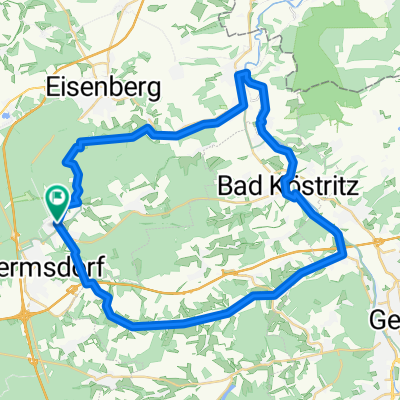
Klosterlausnitz Gera quiet streets Gera Hartmannsdorf Elsterradweg then up to Klosterlausnitz with a slight incline and very shady. then to the spa.
- -:--
- Duration
- 50.5 km
- Distance
- 333 m
- Ascent
- 333 m
- Descent
- ---
- Avg. speed
- ---
- Max. altitude
Route highlights
Points of interest along the route
Point of interest after 0 km
Parkplatz auch für Wohnmobile, 10€ Nacht
Continue with Bikemap
Use, edit, or download this cycling route
You would like to ride Bad Klosterlausnitz- Köstritz-Gera or customize it for your own trip? Here is what you can do with this Bikemap route:
Free features
- Save this route as favorite or in collections
- Copy & plan your own version of this route
- Sync your route with Garmin or Wahoo
Premium features
Free trial for 3 days, or one-time payment. More about Bikemap Premium.
- Navigate this route on iOS & Android
- Export a GPX / KML file of this route
- Create your custom printout (try it for free)
- Download this route for offline navigation
Discover more Premium features.
Get Bikemap PremiumFrom our community
Other popular routes starting in Bad Klosterlausnitz
 Mühltalrunde
- Distance
- 43.5 km
- Ascent
- 255 m
- Descent
- 255 m
- Location
- Bad Klosterlausnitz, Thuringia, Germany
 Bad Klosterlausnitz- Köstritz-Gera
- Distance
- 50.5 km
- Ascent
- 333 m
- Descent
- 333 m
- Location
- Bad Klosterlausnitz, Thuringia, Germany
 BadK-Gera Elsterradweg-Hartmannsdorf-Mühltahl
- Distance
- 52 km
- Ascent
- 308 m
- Descent
- 308 m
- Location
- Bad Klosterlausnitz, Thuringia, Germany
 Rennbahn und um den Pechofen
- Distance
- 9.3 km
- Ascent
- 149 m
- Descent
- 146 m
- Location
- Bad Klosterlausnitz, Thuringia, Germany
 Tag 3 Tour 2023
- Distance
- 61.5 km
- Ascent
- 379 m
- Descent
- 437 m
- Location
- Bad Klosterlausnitz, Thuringia, Germany
 Eisenberg / Mühltal und zurück
- Distance
- 19.8 km
- Ascent
- 270 m
- Descent
- 270 m
- Location
- Bad Klosterlausnitz, Thuringia, Germany
 BadK-Stadtroda-Jena-Großlöbichau-Bürgel-Bad K
- Distance
- 59.6 km
- Ascent
- 410 m
- Descent
- 412 m
- Location
- Bad Klosterlausnitz, Thuringia, Germany
 BAd Klosterlausnitz - Chemnitz
- Distance
- 109.9 km
- Ascent
- 523 m
- Descent
- 547 m
- Location
- Bad Klosterlausnitz, Thuringia, Germany
Open it in the app