Einführungsrunde 2009
- 104.2 km
- 301 m
- 281 m
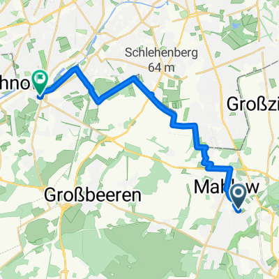
- Lichtenrade, State of Berlin, Germany
A cycling route starting in Lichtenrade, State of Berlin, Germany.
Overview
This is the extended cycling tour that includes Wietstock and especially Märkisch Wilmersdorf
created this 9 years ago
Route quality
Track
31.9 km
(55 %)
Path
11 km
(19 %)
Paved
41.8 km
(72 %)
Unpaved
13.3 km
(23 %)
Asphalt
23.8 km
(41 %)
Concrete
16.8 km
(29 %)
Continue with Bikemap
You would like to ride rund um den Nuthegraben II or customize it for your own trip? Here is what you can do with this Bikemap route:
Free trial for 3 days, or one-time payment. More about Bikemap Premium.
Discover more Premium features.
Get Bikemap PremiumFrom our community
Open it in the app