

Long ride from Kranjska Gora to Kobarid
A cycling route starting in Kranjska Gora, Kranjska Gora, Slovenia.
Overview
About this route
- -:--
- Duration
- 67.9 km
- Distance
- 923 m
- Ascent
- 1,526 m
- Descent
- ---
- Avg. speed
- ---
- Max. altitude
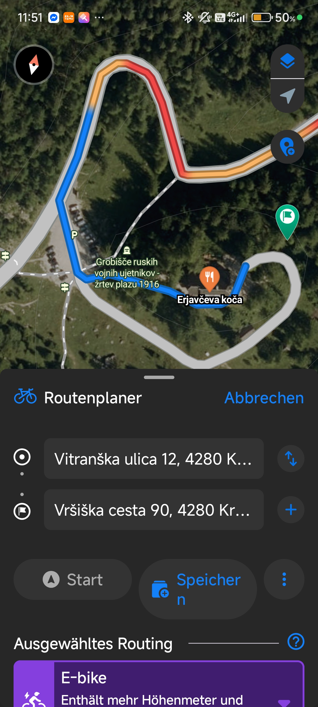
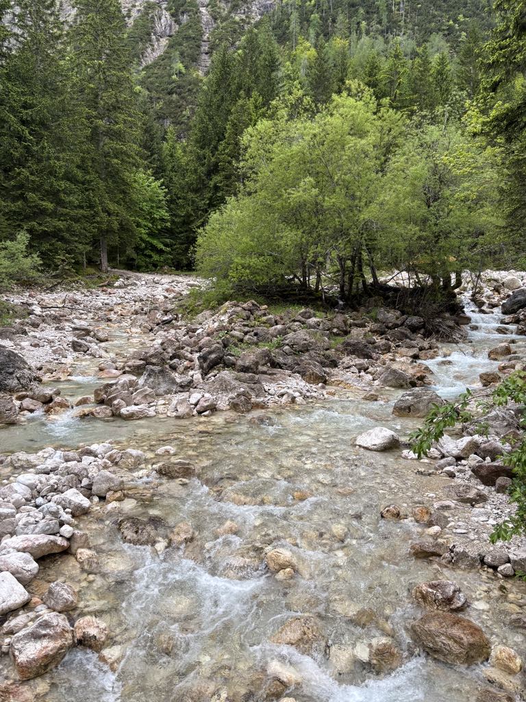
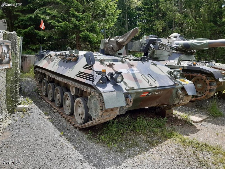
Route photos

Route quality
Waytypes & surfaces along the route
Waytypes
Quiet road
2 km
(3 %)
Path
1.4 km
(2 %)
Surfaces
Paved
63.8 km
(94 %)
Unpaved
0.7 km
(1 %)
Asphalt
63.8 km
(94 %)
Gravel
0.7 km
(1 %)
Undefined
3.4 km
(5 %)
Route highlights
Points of interest along the route
Point of interest after 67.8 km
Kranjska Gora - Vršič- Kobarid
Continue with Bikemap
Use, edit, or download this cycling route
You would like to ride Long ride from Kranjska Gora to Kobarid or customize it for your own trip? Here is what you can do with this Bikemap route:
Free features
- Save this route as favorite or in collections
- Copy & plan your own version of this route
- Sync your route with Garmin or Wahoo
Premium features
Free trial for 3 days, or one-time payment. More about Bikemap Premium.
- Navigate this route on iOS & Android
- Export a GPX / KML file of this route
- Create your custom printout (try it for free)
- Download this route for offline navigation
Discover more Premium features.
Get Bikemap PremiumFrom our community
Other popular routes starting in Kranjska Gora
 Karavanke: Rateče - Tržič
- Distance
- 104.5 km
- Ascent
- 3,302 m
- Descent
- 3,633 m
- Location
- Kranjska Gora, Kranjska Gora, Slovenia
 Nassfeld - Podkoren
- Distance
- 128.2 km
- Ascent
- 1,722 m
- Descent
- 1,718 m
- Location
- Kranjska Gora, Kranjska Gora, Slovenia
 Kranjska Gora - Bovec Etappe 1
- Distance
- 13.9 km
- Ascent
- 1,137 m
- Descent
- 368 m
- Location
- Kranjska Gora, Kranjska Gora, Slovenia
 Zoza 3.Tag VM Kranjska Gora - Dom na Vrsicu - Bohinj-
- Distance
- 12.8 km
- Ascent
- 1,035 m
- Descent
- 349 m
- Location
- Kranjska Gora, Kranjska Gora, Slovenia
 1.7. Kranjska Gora - Villach
- Distance
- 30.3 km
- Ascent
- 500 m
- Descent
- 808 m
- Location
- Kranjska Gora, Kranjska Gora, Slovenia
 KrGora-Mangrt-Vršič-KrGora
- Distance
- 109.6 km
- Ascent
- 2,673 m
- Descent
- 2,673 m
- Location
- Kranjska Gora, Kranjska Gora, Slovenia
 Bleder See
- Distance
- 65.9 km
- Ascent
- 643 m
- Descent
- 643 m
- Location
- Kranjska Gora, Kranjska Gora, Slovenia
 Kranjska Gora - Radovna -Bled -Jesenice - Kranjska Gora
- Distance
- 68.2 km
- Ascent
- 586 m
- Descent
- 570 m
- Location
- Kranjska Gora, Kranjska Gora, Slovenia
Open it in the app