

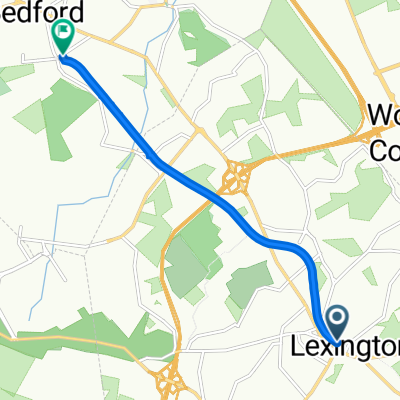
Acton/Maynard no Rte 2
A cycling route starting in Lexington, Massachusetts, United States.
Overview
About this route
- -:--
- Duration
- 45.2 km
- Distance
- 179 m
- Ascent
- 203 m
- Descent
- ---
- Avg. speed
- ---
- Max. altitude
Route quality
Waytypes & surfaces along the route
Waytypes
Road
5.9 km
(13 %)
Quiet road
5 km
(11 %)
Surfaces
Paved
34.8 km
(77 %)
Asphalt
34.3 km
(76 %)
Paved (undefined)
0.5 km
(1 %)
Undefined
10.4 km
(23 %)
Continue with Bikemap
Use, edit, or download this cycling route
You would like to ride Acton/Maynard no Rte 2 or customize it for your own trip? Here is what you can do with this Bikemap route:
Free features
- Save this route as favorite or in collections
- Copy & plan your own version of this route
- Sync your route with Garmin or Wahoo
Premium features
Free trial for 3 days, or one-time payment. More about Bikemap Premium.
- Navigate this route on iOS & Android
- Export a GPX / KML file of this route
- Create your custom printout (try it for free)
- Download this route for offline navigation
Discover more Premium features.
Get Bikemap PremiumFrom our community
Other popular routes starting in Lexington
 Acton/Maynard no Rte 2
- Distance
- 45.2 km
- Ascent
- 179 m
- Descent
- 203 m
- Location
- Lexington, Massachusetts, United States
 Minuteman Commuter Bikeway, Lexington to 74 Loomis St, Bedford
- Distance
- 6.2 km
- Ascent
- 20 m
- Descent
- 50 m
- Location
- Lexington, Massachusetts, United States
 Liberty Square 50-miler
- Distance
- 85.5 km
- Ascent
- 509 m
- Descent
- 522 m
- Location
- Lexington, Massachusetts, United States
 FirstRun
- Distance
- 7.6 km
- Ascent
- 60 m
- Descent
- 97 m
- Location
- Lexington, Massachusetts, United States
 half lex loop
- Distance
- 30.9 km
- Ascent
- 141 m
- Descent
- 140 m
- Location
- Lexington, Massachusetts, United States
 60 Bedford St, Lexington to 1407 Stearns Hill Rd, Waltham
- Distance
- 6.7 km
- Ascent
- 63 m
- Descent
- 66 m
- Location
- Lexington, Massachusetts, United States
 Verrill Farm Loop
- Distance
- 54 km
- Ascent
- 406 m
- Descent
- 431 m
- Location
- Lexington, Massachusetts, United States
 Charles river full
- Distance
- 64.8 km
- Ascent
- 441 m
- Descent
- 440 m
- Location
- Lexington, Massachusetts, United States
Open it in the app