

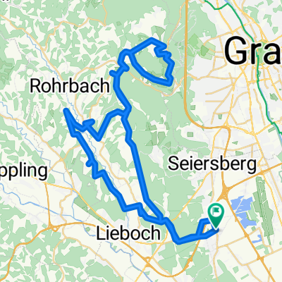
Steiermark 2 - Westl. Steiermark
- 56.4 km
- 535 m
- 535 m
- Unterpremstätten, Styria, Austria
A cycling route starting in Unterpremstätten, Styria, Austria.
Overview
beautiful route with sometimes dreamlike views in Western Styria, relatively little traffic on the roads, moderate climbs
created this 9 years ago
Route quality
Quiet road
15.9 km
(43 %)
Cycleway
4.1 km
(11 %)
Paved
20.3 km
(55 %)
Unpaved
0.4 km
(1 %)
Asphalt
20.3 km
(55 %)
Loose gravel
0.4 km
(1 %)
Undefined
16.3 km
(44 %)
Continue with Bikemap
You would like to ride schwarzlsee-wundschuh-gantschenberg-preding-tobisegg-dobl-unterpremstätten or customize it for your own trip? Here is what you can do with this Bikemap route:
Free trial for 3 days, or one-time payment. More about Bikemap Premium.
Discover more Premium features.
Get Bikemap PremiumFrom our community
Open it in the app


