

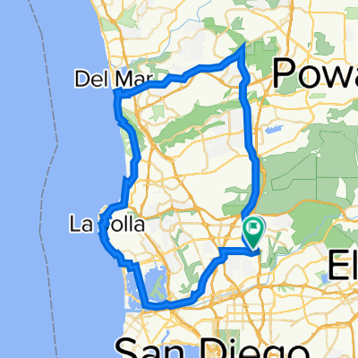
Tierrasanta & MCAS Loop
A cycling route starting in La Mesa, California, United States.
Overview
About this route
Goes through Tierrsana and then out to MCAS and back.
- -:--
- Duration
- 44 km
- Distance
- 401 m
- Ascent
- 401 m
- Descent
- ---
- Avg. speed
- ---
- Max. altitude
Route quality
Waytypes & surfaces along the route
Waytypes
Road
11 km
(25 %)
Quiet road
1.3 km
(3 %)
Surfaces
Paved
32.1 km
(73 %)
Asphalt
32.1 km
(73 %)
Undefined
11.9 km
(27 %)
Continue with Bikemap
Use, edit, or download this cycling route
You would like to ride Tierrasanta & MCAS Loop or customize it for your own trip? Here is what you can do with this Bikemap route:
Free features
- Save this route as favorite or in collections
- Copy & plan your own version of this route
- Sync your route with Garmin or Wahoo
Premium features
Free trial for 3 days, or one-time payment. More about Bikemap Premium.
- Navigate this route on iOS & Android
- Export a GPX / KML file of this route
- Create your custom printout (try it for free)
- Download this route for offline navigation
Discover more Premium features.
Get Bikemap PremiumFrom our community
Other popular routes starting in La Mesa
 20110711 Mission Trails Regional Park
- Distance
- 11.9 km
- Ascent
- 335 m
- Descent
- 338 m
- Location
- La Mesa, California, United States
 Sunday Morning
- Distance
- 71.7 km
- Ascent
- 400 m
- Descent
- 392 m
- Location
- La Mesa, California, United States
 Tierrasanta & MCAS Loop
- Distance
- 44 km
- Ascent
- 401 m
- Descent
- 401 m
- Location
- La Mesa, California, United States
 Lake Murray
- Distance
- 9.1 km
- Ascent
- 21 m
- Descent
- 19 m
- Location
- La Mesa, California, United States
 Chili's Ride
- Distance
- 60.7 km
- Ascent
- 330 m
- Descent
- 332 m
- Location
- La Mesa, California, United States
 Del Mar Fairgrounds
- Distance
- 31.1 km
- Ascent
- 233 m
- Descent
- 182 m
- Location
- La Mesa, California, United States
 Bruce Millikin Century NOV2013 TREK
- Distance
- 161.3 km
- Ascent
- 720 m
- Descent
- 720 m
- Location
- La Mesa, California, United States
 Chargers Day Ride
- Distance
- 80.2 km
- Ascent
- 529 m
- Descent
- 479 m
- Location
- La Mesa, California, United States
Open it in the app