

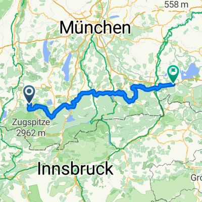
Wildsteig - Halblech
A cycling route starting in Wildsteig, Bavaria, Germany.
Overview
About this route
Unser Ausgangspunkt: Parkplatz Schönegger Käsealm (Einkehrmöglichkeit, am besten nach der Tour).
Pfaffenwinkeltour entlang Wieskirche (Vorsicht, handyblinde Japaner - Smartphone-Zombies überqueren den Weg zur Wieskirche!!) bis nach Buching (Halblech) und Buchenbergalm (Einkehrmöglichkeit)
- -:--
- Duration
- 25.9 km
- Distance
- 503 m
- Ascent
- 232 m
- Descent
- ---
- Avg. speed
- ---
- Max. altitude
Route quality
Waytypes & surfaces along the route
Waytypes
Quiet road
16.1 km
(62 %)
Track
7.5 km
(29 %)
Surfaces
Paved
19.9 km
(77 %)
Unpaved
2.2 km
(8 %)
Asphalt
18.8 km
(73 %)
Loose gravel
1.3 km
(5 %)
Continue with Bikemap
Use, edit, or download this cycling route
You would like to ride Wildsteig - Halblech or customize it for your own trip? Here is what you can do with this Bikemap route:
Free features
- Save this route as favorite or in collections
- Copy & plan your own version of this route
- Sync your route with Garmin or Wahoo
Premium features
Free trial for 3 days, or one-time payment. More about Bikemap Premium.
- Navigate this route on iOS & Android
- Export a GPX / KML file of this route
- Create your custom printout (try it for free)
- Download this route for offline navigation
Discover more Premium features.
Get Bikemap PremiumFrom our community
Other popular routes starting in Wildsteig
 Winterwanderung - Geizenmoos
- Distance
- 12.8 km
- Ascent
- 124 m
- Descent
- 125 m
- Location
- Wildsteig, Bavaria, Germany
 Bodensee Königssee Radweg
- Distance
- 189 km
- Ascent
- 2,448 m
- Descent
- 2,720 m
- Location
- Wildsteig, Bavaria, Germany
 Große Rastrunde
- Distance
- 30.1 km
- Ascent
- 523 m
- Descent
- 523 m
- Location
- Wildsteig, Bavaria, Germany
 Wildsteig-Unternogg-Wies
- Distance
- 29.8 km
- Ascent
- 496 m
- Descent
- 496 m
- Location
- Wildsteig, Bavaria, Germany
 Um die Wies
- Distance
- 26.3 km
- Ascent
- 332 m
- Descent
- 332 m
- Location
- Wildsteig, Bavaria, Germany
 Groß Bicheleck
- Distance
- 13.6 km
- Ascent
- 237 m
- Descent
- 237 m
- Location
- Wildsteig, Bavaria, Germany
 Tour 2 Bayersoien
- Distance
- 19.7 km
- Ascent
- 287 m
- Descent
- 301 m
- Location
- Wildsteig, Bavaria, Germany
 An der Bleick
- Distance
- 32.1 km
- Ascent
- 788 m
- Descent
- 788 m
- Location
- Wildsteig, Bavaria, Germany
Open it in the app