Schlier-Pfänder
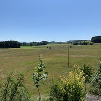
A cycling route starting in Schlier, Baden-Württemberg, Germany.
Overview
About this route
- -:--
- Duration
- 49.4 km
- Distance
- 769 m
- Ascent
- 370 m
- Descent
- ---
- Avg. speed
- ---
- Avg. speed
Route quality
Waytypes & surfaces along the route
Waytypes
Quiet road
23.9 km
(48 %)
Road
8.2 km
(17 %)
Surfaces
Paved
37.9 km
(77 %)
Unpaved
8.7 km
(18 %)
Asphalt
37.8 km
(76 %)
Gravel
6.4 km
(13 %)
Continue with Bikemap
Use, edit, or download this cycling route
You would like to ride Schlier-Pfänder or customize it for your own trip? Here is what you can do with this Bikemap route:
Free features
- Save this route as favorite or in collections
- Copy & plan your own version of this route
- Sync your route with Garmin or Wahoo
Premium features
Free trial for 3 days, or one-time payment. More about Bikemap Premium.
- Navigate this route on iOS & Android
- Export a GPX / KML file of this route
- Create your custom printout (try it for free)
- Download this route for offline navigation
Discover more Premium features.
Get Bikemap PremiumFrom our community
Other popular routes starting in Schlier
- Starenweg 3, Schlier nach Starenweg 20, Schlier
- Distance
- 26.4 km
- Ascent
- 488 m
- Descent
- 491 m
- Location
- Schlier, Baden-Württemberg, Germany
- Schlier Grund
- Distance
- 11.5 km
- Ascent
- 205 m
- Descent
- 157 m
- Location
- Schlier, Baden-Württemberg, Germany
- OEBOR
- Distance
- 38.1 km
- Ascent
- 440 m
- Descent
- 440 m
- Location
- Schlier, Baden-Württemberg, Germany
- Pfänder von Schlier aus
- Distance
- 98.1 km
- Ascent
- 1,092 m
- Descent
- 1,098 m
- Location
- Schlier, Baden-Württemberg, Germany
- UA-Vogt-UA
- Distance
- 18.9 km
- Ascent
- 311 m
- Descent
- 302 m
- Location
- Schlier, Baden-Württemberg, Germany
- Schlier Cafe NuberSchlier
- Distance
- 47.2 km
- Ascent
- 435 m
- Descent
- 427 m
- Location
- Schlier, Baden-Württemberg, Germany
- Langsame Fahrt in Kißlegg
- Distance
- 20.5 km
- Ascent
- 518 m
- Descent
- 520 m
- Location
- Schlier, Baden-Württemberg, Germany
- Süh-Wolfegg -Vogt
- Distance
- 27.3 km
- Ascent
- 333 m
- Descent
- 333 m
- Location
- Schlier, Baden-Württemberg, Germany
Open it in the app