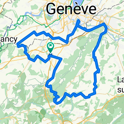
Stef@ns Tour zur Tour 2004 3. Etappe Teil 1 vom 18.07.04
A cycling route starting in Neydens, Auvergne-Rh么ne-Alpes, France.
Overview
About this route
Stef@ns Tour zur Tour de France 2004
- Etappe Teil 1 vom 18.07.04
聽
Neydens - Annecy - Aix-Les-Bains - Chamb茅ry
- -:--
- Duration
- 85.2 km
- Distance
- 589 m
- Ascent
- 875 m
- Descent
- ---
- Avg. speed
- ---
- Avg. speed
Route highlights
Points of interest along the route
Point of interest after 16.2 km
die alte H盲ngebr眉cke "Pont de la Caille"
Point of interest after 84.9 km
Es ist Sonntag, ich sitze in einem Caf茅, schaue die Tour-Etappe im TV und studiere nebenbei die Carte Michelin... Hier f盲llt auch die Entscheidung, den Col de la Madelaine selbst zu fahren..
Continue with Bikemap
Use, edit, or download this cycling route
You would like to ride Stef@ns Tour zur Tour 2004 3. Etappe Teil 1 vom 18.07.04 or customize it for your own trip? Here is what you can do with this Bikemap route:
Free features
- Save this route as favorite or in collections
- Copy & plan your own version of this route
- Sync your route with Garmin or Wahoo
Premium features
Free trial for 3 days, or one-time payment. More about Bikemap Premium.
- Navigate this route on iOS & Android
- Export a GPX / KML file of this route
- Create your custom printout (try it for free)
- Download this route for offline navigation
Discover more Premium features.
Get Bikemap PremiumFrom our community
Other popular routes starting in Neydens
- Circuit Neydens - Valleiry 48 km
- Distance
- 48.5 km
- Ascent
- 709 m
- Descent
- 709 m
- Location
- Neydens, Auvergne-Rh么ne-Alpes, France
- Saleve Snow Loop
- Distance
- 39.2 km
- Ascent
- 932 m
- Descent
- 898 m
- Location
- Neydens, Auvergne-Rh么ne-Alpes, France
- Stef@ns Tour zur Tour 2004 3. Etappe Teil 1 vom 18.07.04
- Distance
- 85.2 km
- Ascent
- 589 m
- Descent
- 875 m
- Location
- Neydens, Auvergne-Rh么ne-Alpes, France
- Le Saleve
- Distance
- 26.1 km
- Ascent
- 1,019 m
- Descent
- 975 m
- Location
- Neydens, Auvergne-Rh么ne-Alpes, France
- Le Saleve the steep way
- Distance
- 42.8 km
- Ascent
- 1,203 m
- Descent
- 1,134 m
- Location
- Neydens, Auvergne-Rh么ne-Alpes, France
- Mont Saleve half
- Distance
- 19.1 km
- Ascent
- 466 m
- Descent
- 465 m
- Location
- Neydens, Auvergne-Rh么ne-Alpes, France
- Mont Saleve 1
- Distance
- 33.7 km
- Ascent
- 836 m
- Descent
- 837 m
- Location
- Neydens, Auvergne-Rh么ne-Alpes, France
- Mont Saleve Huts
- Distance
- 15.9 km
- Ascent
- 320 m
- Descent
- 319 m
- Location
- Neydens, Auvergne-Rh么ne-Alpes, France
Open it in the app