

Tour de France 2016 dzień 19
A cycling route starting in Fontaines-sur-Saône, Auvergne-Rhône-Alpes, France.
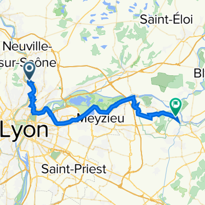
Overview
About this route
LYON – Albigny sur Saône (D51) – Quincieux – Grand Veissieux – Ambiereux – ANSE (D306) – VILLEFRANCHE SUR SAÔNE (D686-D306) – Saint Georges de Reneins – Belleville – Les Grandes Bruyeres – Les Bulands (D466BIS) - Saint Romain des Iles – Arciat – MACON – La Bejarde – Le Vilars – Tornus (D37-Rive Gauche) – Saône (bank)
- -:--
- Duration
- 101 km
- Distance
- 112 m
- Ascent
- 108 m
- Descent
- ---
- Avg. speed
- ---
- Max. altitude

Route quality
Waytypes & surfaces along the route
Waytypes
Path
26.3 km
(26 %)
Quiet road
18.2 km
(18 %)
Surfaces
Paved
57.6 km
(57 %)
Unpaved
24.2 km
(24 %)
Asphalt
56.6 km
(56 %)
Loose gravel
15.2 km
(15 %)
Continue with Bikemap
Use, edit, or download this cycling route
You would like to ride Tour de France 2016 dzień 19 or customize it for your own trip? Here is what you can do with this Bikemap route:
Free features
- Save this route as favorite or in collections
- Copy & plan your own version of this route
- Split it into stages to create a multi-day tour
- Sync your route with Garmin or Wahoo
Premium features
Free trial for 3 days, or one-time payment. More about Bikemap Premium.
- Navigate this route on iOS & Android
- Export a GPX / KML file of this route
- Create your custom printout (try it for free)
- Download this route for offline navigation
Discover more Premium features.
Get Bikemap PremiumFrom our community
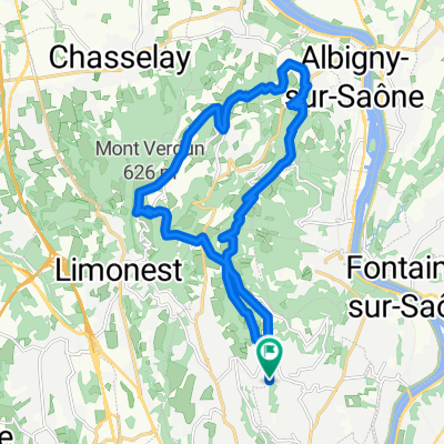
Other popular routes starting in Fontaines-sur-Saône
 Parcours dimanche 2302
- Distance
- 52.3 km
- Ascent
- 375 m
- Descent
- 377 m
- Location
- Fontaines-sur-Saône, Auvergne-Rhône-Alpes, France
 Fontaine-sur-Saône - Mâcon
- Distance
- 68.3 km
- Ascent
- 47 m
- Descent
- 42 m
- Location
- Fontaines-sur-Saône, Auvergne-Rhône-Alpes, France
 Big VTT man
- Distance
- 144.7 km
- Ascent
- 3,774 m
- Descent
- 3,779 m
- Location
- Fontaines-sur-Saône, Auvergne-Rhône-Alpes, France
 Margot route
- Distance
- 54.6 km
- Ascent
- 286 m
- Descent
- 285 m
- Location
- Fontaines-sur-Saône, Auvergne-Rhône-Alpes, France
 Tour de France 2016 dzień 19
- Distance
- 101 km
- Ascent
- 112 m
- Descent
- 108 m
- Location
- Fontaines-sur-Saône, Auvergne-Rhône-Alpes, France
 Émeline
- Distance
- 41.3 km
- Ascent
- 279 m
- Descent
- 241 m
- Location
- Fontaines-sur-Saône, Auvergne-Rhône-Alpes, France
 MTDOR_CLASSIC
- Distance
- 21.6 km
- Ascent
- 816 m
- Descent
- 813 m
- Location
- Fontaines-sur-Saône, Auvergne-Rhône-Alpes, France
 c1 Le circuit de Béa
- Distance
- 19.5 km
- Ascent
- 186 m
- Descent
- 183 m
- Location
- Fontaines-sur-Saône, Auvergne-Rhône-Alpes, France
Open it in the app