
el reto del domingo
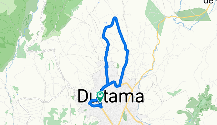
A cycling route starting in Duitama, Departamento de Boyacá, Colombia.
Overview
About this route
Starts at the Ricafer store.. first mountain prize 'La Gabriela', followed by the first sprint from 'El Timonel' to 'Tienda Tía Ana', second mountain prize 'Ascenso al Cogollo', last mountain prize 'I challenge you to climb seated'.. descent and sprint to the Salesian school chapel, second sprint from 'Salesiano' to 'Conjunto Santa Lucía', descent along John F. Kennedy Avenue to Parque Las Américas, finishing at the Ricafer store.. GOOD LUCK..!!
- -:--
- Duration
- 11.9 km
- Distance
- 400 m
- Ascent
- 400 m
- Descent
- ---
- Avg. speed
- ---
- Max. altitude
Route quality
Waytypes & surfaces along the route
Waytypes
Quiet road
8.1 km
(68 %)
Cycleway
0.8 km
(7 %)
Undefined
3 km
(25 %)
Surfaces
Paved
9.7 km
(81 %)
Paved (undefined)
7.3 km
(61 %)
Asphalt
2.3 km
(19 %)
Continue with Bikemap
Use, edit, or download this cycling route
You would like to ride el reto del domingo or customize it for your own trip? Here is what you can do with this Bikemap route:
Free features
- Save this route as favorite or in collections
- Copy & plan your own version of this route
- Sync your route with Garmin or Wahoo
Premium features
Free trial for 3 days, or one-time payment. More about Bikemap Premium.
- Navigate this route on iOS & Android
- Export a GPX / KML file of this route
- Create your custom printout (try it for free)
- Download this route for offline navigation
Discover more Premium features.
Get Bikemap PremiumFrom our community
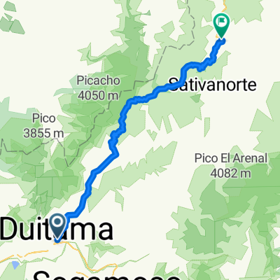
Other popular routes starting in Duitama
 el reto del domingo
- Distance
- 11.9 km
- Ascent
- 400 m
- Descent
- 400 m
- Location
- Duitama, Departamento de Boyacá, Colombia
 ocho 1
- Distance
- 14.1 km
- Ascent
- 510 m
- Descent
- 240 m
- Location
- Duitama, Departamento de Boyacá, Colombia
 De Duitama a Calle 21 27-27, Duitama
- Distance
- 12 km
- Ascent
- 297 m
- Descent
- 309 m
- Location
- Duitama, Departamento de Boyacá, Colombia
 Cristo rey-La tribuna1
- Distance
- 15.7 km
- Ascent
- 6 m
- Descent
- 308 m
- Location
- Duitama, Departamento de Boyacá, Colombia
 Duitama-Susacón
- Distance
- 85.9 km
- Ascent
- 1,458 m
- Descent
- 1,475 m
- Location
- Duitama, Departamento de Boyacá, Colombia
 Duitama- Sochagota- Pantano de Vargas
- Distance
- 76.6 km
- Ascent
- 1,418 m
- Descent
- 1,416 m
- Location
- Duitama, Departamento de Boyacá, Colombia
 Ruta Champions Libertadores
- Distance
- 11.4 km
- Ascent
- 388 m
- Descent
- 375 m
- Location
- Duitama, Departamento de Boyacá, Colombia
 4-sirata1
- Distance
- 11.2 km
- Ascent
- 417 m
- Descent
- 413 m
- Location
- Duitama, Departamento de Boyacá, Colombia
Open it in the app