St Ninian's Way - Creetown to Newton Stewart
A cycling route starting in Newton Stewart, Scotland, United Kingdom.
Overview
About this route
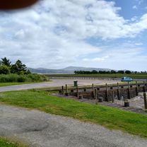
The 9th section of St Ninian’s Way takes Bike Route 7 north from Creetown along minor roads and tracks to Stronord, then on to Newton Stewart.
Minor ups and downs through farmland with River Cree to west.
For a map overview of Part 1 and Part 2 of St Ninian’s Way please go to https://www.bikemap.net/en/route/3548129-st-ninians-way-carlisle-to-st-andrews-part-1-carlisle-to-whithorn/
St Ninian’s Way is one of the great pilgrim routes in Scotland to St Andrews - The Way of St Andrews - For other routes see http://www.thewayofstandrews.com
- -:--
- Duration
- 11.5 km
- Distance
- 160 m
- Ascent
- 160 m
- Descent
- ---
- Avg. speed
- ---
- Avg. speed
Route quality
Waytypes & surfaces along the route
Waytypes
Cycleway
4.9 km
(43 %)
Quiet road
4.5 km
(39 %)
Surfaces
Paved
4.7 km
(41 %)
Asphalt
4.7 km
(41 %)
Undefined
6.8 km
(59 %)
Continue with Bikemap
Use, edit, or download this cycling route
You would like to ride St Ninian's Way - Creetown to Newton Stewart or customize it for your own trip? Here is what you can do with this Bikemap route:
Free features
- Save this route as favorite or in collections
- Copy & plan your own version of this route
- Sync your route with Garmin or Wahoo
Premium features
Free trial for 3 days, or one-time payment. More about Bikemap Premium.
- Navigate this route on iOS & Android
- Export a GPX / KML file of this route
- Create your custom printout (try it for free)
- Download this route for offline navigation
Discover more Premium features.
Get Bikemap PremiumFrom our community
Other popular routes starting in Newton Stewart
- Newton Stewart-Whauphill-Wigton Circular
- Distance
- 46.4 km
- Ascent
- 178 m
- Descent
- 182 m
- Location
- Newton Stewart, Scotland, United Kingdom
- Loch Trool Loop.
- Distance
- 10.5 km
- Ascent
- 225 m
- Descent
- 227 m
- Location
- Newton Stewart, Scotland, United Kingdom
- From Creetown to the viaduct
- Distance
- 21.7 km
- Ascent
- 313 m
- Descent
- 312 m
- Location
- Newton Stewart, Scotland, United Kingdom
- Newton Stewart Glentrool Village circular
- Distance
- 42 km
- Ascent
- 383 m
- Descent
- 384 m
- Location
- Newton Stewart, Scotland, United Kingdom
- Home to Wigtown return
- Distance
- 32.2 km
- Ascent
- 289 m
- Descent
- 287 m
- Location
- Newton Stewart, Scotland, United Kingdom
- Glen Troll V1
- Distance
- 23.5 km
- Ascent
- 421 m
- Descent
- 421 m
- Location
- Newton Stewart, Scotland, United Kingdom
- 1.4 Southern Upland Way
- Distance
- 7.9 km
- Ascent
- 103 m
- Descent
- 138 m
- Location
- Newton Stewart, Scotland, United Kingdom
- Mid Galloway and Wigtown West Ward, Newton Stewart to Mid Galloway and Wigtown West Ward, Newton Stewart
- Distance
- 23.8 km
- Ascent
- 431 m
- Descent
- 434 m
- Location
- Newton Stewart, Scotland, United Kingdom