

St Ninian's Way - Newtown Stewart to Wigtown
A cycling route starting in Newton Stewart, Scotland, United Kingdom.
Overview
About this route
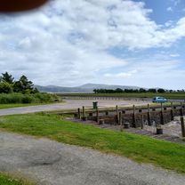
The 10th section of St Ninian’s Way takes Bike Route 73 (On A714 and accompanying core path) south out of Newton Stewart past the Y junction by St Ninian's Well (3 km) and then, turning left, down to Wigtown, with the Cree and Wigtown Bay to the east.
Flat after a short descent into farmland bordering the Cree.
For a map overview of Part 1 and Part 2 of St Ninian’s Way please go to https://www.bikemap.net/en/route/3548129-st-ninians-way-carlisle-to-st-andrews-part-1-carlisle-to-whithorn/
St Ninian’s Way is one of the great pilgrim routes in Scotland to St Andrews - The Way of St Andrews - For other routes see http://www.thewayofstandrews.com
- -:--
- Duration
- 13.1 km
- Distance
- 56 m
- Ascent
- 25 m
- Descent
- ---
- Avg. speed
- ---
- Max. altitude

Route quality
Waytypes & surfaces along the route
Waytypes
Quiet road
10.1 km
(77 %)
Path
1.2 km
(9 %)
Undefined
1.8 km
(14 %)
Surfaces
Paved
1.2 km
(9 %)
Asphalt
1.2 km
(9 %)
Undefined
11.9 km
(91 %)
Route highlights
Points of interest along the route
Point of interest after 3.2 km
St Ninian's Well
Continue with Bikemap
Use, edit, or download this cycling route
You would like to ride St Ninian's Way - Newtown Stewart to Wigtown or customize it for your own trip? Here is what you can do with this Bikemap route:
Free features
- Save this route as favorite or in collections
- Copy & plan your own version of this route
- Sync your route with Garmin or Wahoo
Premium features
Free trial for 3 days, or one-time payment. More about Bikemap Premium.
- Navigate this route on iOS & Android
- Export a GPX / KML file of this route
- Create your custom printout (try it for free)
- Download this route for offline navigation
Discover more Premium features.
Get Bikemap PremiumFrom our community
Other popular routes starting in Newton Stewart
 Glen Troll V1
- Distance
- 23.5 km
- Ascent
- 421 m
- Descent
- 421 m
- Location
- Newton Stewart, Scotland, United Kingdom
 1.4 Southern Upland Way
- Distance
- 7.9 km
- Ascent
- 103 m
- Descent
- 138 m
- Location
- Newton Stewart, Scotland, United Kingdom
 Loch Trool Loop.
- Distance
- 10.5 km
- Ascent
- 225 m
- Descent
- 227 m
- Location
- Newton Stewart, Scotland, United Kingdom
 loch chatteringshaw
- Distance
- 23.1 km
- Ascent
- 264 m
- Descent
- 259 m
- Location
- Newton Stewart, Scotland, United Kingdom
 Newton Stewart Glentrool Village circular
- Distance
- 42 km
- Ascent
- 383 m
- Descent
- 384 m
- Location
- Newton Stewart, Scotland, United Kingdom
 Home to Wigtown return
- Distance
- 32.2 km
- Ascent
- 289 m
- Descent
- 287 m
- Location
- Newton Stewart, Scotland, United Kingdom
 Newton Stewart to Wigtown Circular 2
- Distance
- 47.3 km
- Ascent
- 272 m
- Descent
- 274 m
- Location
- Newton Stewart, Scotland, United Kingdom
 Newton Stewart-Whauphill-Wigton Circular
- Distance
- 46.4 km
- Ascent
- 178 m
- Descent
- 182 m
- Location
- Newton Stewart, Scotland, United Kingdom
Open it in the app