

50tka
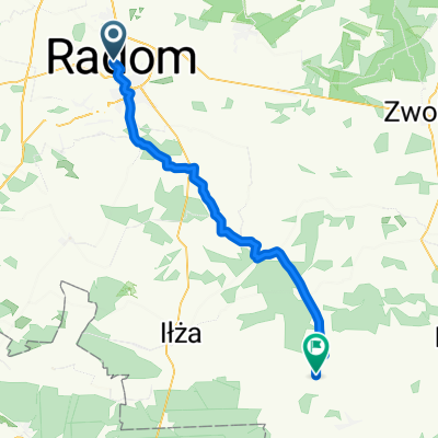
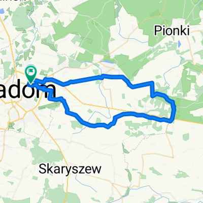
A cycling route starting in Radom, Masovian Voivodeship, Poland.
Overview
About this route
- -:--
- Duration
- 51 km
- Distance
- 115 m
- Ascent
- 118 m
- Descent
- ---
- Avg. speed
- ---
- Max. altitude
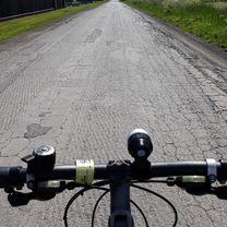
Route photos


Route quality
Waytypes & surfaces along the route
Waytypes
Road
26.5 km
(52 %)
Quiet road
7.1 km
(14 %)
Surfaces
Paved
26.5 km
(52 %)
Unpaved
1 km
(2 %)
Asphalt
26.5 km
(52 %)
Ground
1 km
(2 %)
Undefined
23.5 km
(46 %)
Route highlights
Points of interest along the route

Point of interest after 20.5 km
dookoła łąki

Point of interest after 20.5 km
foto
Continue with Bikemap
Use, edit, or download this cycling route
You would like to ride 50tka or customize it for your own trip? Here is what you can do with this Bikemap route:
Free features
- Save this route as favorite or in collections
- Copy & plan your own version of this route
- Sync your route with Garmin or Wahoo
Premium features
Free trial for 3 days, or one-time payment. More about Bikemap Premium.
- Navigate this route on iOS & Android
- Export a GPX / KML file of this route
- Create your custom printout (try it for free)
- Download this route for offline navigation
Discover more Premium features.
Get Bikemap PremiumFrom our community
Other popular routes starting in Radom
 50tka
50tka- Distance
- 51 km
- Ascent
- 115 m
- Descent
- 118 m
- Location
- Radom, Masovian Voivodeship, Poland
 200 krzyz
- Distance
- 198.7 km
- Ascent
- 1,591 m
- Descent
- 1,481 m
- Location
- Radom, Masovian Voivodeship, Poland
 CoZaJazda Rzeczniow 2025
- Distance
- 43.4 km
- Ascent
- 124 m
- Descent
- 91 m
- Location
- Radom, Masovian Voivodeship, Poland
 Radom 50km
- Distance
- 50.3 km
- Ascent
- 276 m
- Descent
- 276 m
- Location
- Radom, Masovian Voivodeship, Poland
 leśna trasa
- Distance
- 61.2 km
- Ascent
- 157 m
- Descent
- 154 m
- Location
- Radom, Masovian Voivodeship, Poland
 Radom - Grzybowa Góra z małym okładem
- Distance
- 152.8 km
- Ascent
- 422 m
- Descent
- 421 m
- Location
- Radom, Masovian Voivodeship, Poland
 Radom - Ciepielów(Stary Kawęczyn) i z powrotem
- Distance
- 100.4 km
- Ascent
- 137 m
- Descent
- 140 m
- Location
- Radom, Masovian Voivodeship, Poland
 Radom - Podgóra (Gózd) - Radom
- Distance
- 50.5 km
- Ascent
- 144 m
- Descent
- 143 m
- Location
- Radom, Masovian Voivodeship, Poland
Open it in the app