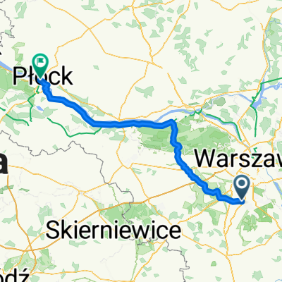
Lokalne 70 km
A cycling route starting in Lesznowola, Masovian Voivodeship, Poland.
Overview
About this route
- -:--
- Duration
- 72.6 km
- Distance
- 135 m
- Ascent
- 135 m
- Descent
- ---
- Avg. speed
- ---
- Avg. speed
Route quality
Waytypes & surfaces along the route
Waytypes
Road
38.5 km
(53 %)
Busy road
11 km
(15 %)
Surfaces
Paved
67.2 km
(93 %)
Unpaved
0.3 km
(<1 %)
Asphalt
60.2 km
(83 %)
Paving stones
4.3 km
(6 %)
Continue with Bikemap
Use, edit, or download this cycling route
You would like to ride Lokalne 70 km or customize it for your own trip? Here is what you can do with this Bikemap route:
Free features
- Save this route as favorite or in collections
- Copy & plan your own version of this route
- Sync your route with Garmin or Wahoo
Premium features
Free trial for 3 days, or one-time payment. More about Bikemap Premium.
- Navigate this route on iOS & Android
- Export a GPX / KML file of this route
- Create your custom printout (try it for free)
- Download this route for offline navigation
Discover more Premium features.
Get Bikemap PremiumFrom our community
Other popular routes starting in Lesznowola
- Alternate route to work
- Distance
- 23.2 km
- Ascent
- 34 m
- Descent
- 54 m
- Location
- Lesznowola, Masovian Voivodeship, Poland
- Nieśpieszny przejazd w
- Distance
- 18.7 km
- Ascent
- 216 m
- Descent
- 215 m
- Location
- Lesznowola, Masovian Voivodeship, Poland
- Marysin - Sosnowiec 2016
- Distance
- 271.8 km
- Ascent
- 468 m
- Descent
- 329 m
- Location
- Lesznowola, Masovian Voivodeship, Poland
- Marysin - Kalisz
- Distance
- 229.4 km
- Ascent
- 350 m
- Descent
- 362 m
- Location
- Lesznowola, Masovian Voivodeship, Poland
- M.I.L.A. Półmaraton
- Distance
- 21.1 km
- Ascent
- 72 m
- Descent
- 72 m
- Location
- Lesznowola, Masovian Voivodeship, Poland
- Lokalne 70 km
- Distance
- 72.6 km
- Ascent
- 135 m
- Descent
- 135 m
- Location
- Lesznowola, Masovian Voivodeship, Poland
- From Lesznowola to Gdynia
- Distance
- 467.2 km
- Ascent
- 1,726 m
- Descent
- 1,699 m
- Location
- Lesznowola, Masovian Voivodeship, Poland
- Tour de Mazovia, dzień 13
- Distance
- 117.6 km
- Ascent
- 190 m
- Descent
- 190 m
- Location
- Lesznowola, Masovian Voivodeship, Poland
Open it in the app