

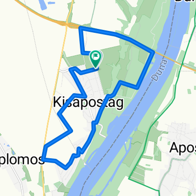
2015 04 10 Kisapostag - Szalki-bányatavak-41,1
A cycling route starting in Apostag, Bács-Kiskun county, Hungary.
Overview
About this route
Total distance: 41.10 km (25.5 mi) Total time: 4:02:03 Moving time: 3:33:58 Average speed: 10.19 km/h (6.3 mi/h) Average moving speed: 11.52 km/h (7.2 mi/h) Max speed: 29.69 km/h (18.4 mi/h) Average pace: 5:53 min/km (9:29 min/mi) Average moving pace: 5:12 min/km (8:23 min/mi) Fastest pace: 2:01 min/km (3:15 min/mi) Max elevation: 188 m (615 ft) Min elevation: 136 m (447 ft) Elevation gain: 279 m (916 ft) Max grade: 8 % Min grade: -7 % Recorded: 10/04/2015 11:07w5IDdaIi8+DQo8L3N2Zz4=
- -:--
- Duration
- 40 km
- Distance
- 95 m
- Ascent
- 96 m
- Descent
- ---
- Avg. speed
- ---
- Max. altitude

Continue with Bikemap
Use, edit, or download this cycling route
You would like to ride 2015 04 10 Kisapostag - Szalki-bányatavak-41,1 or customize it for your own trip? Here is what you can do with this Bikemap route:
Free features
- Save this route as favorite or in collections
- Copy & plan your own version of this route
- Sync your route with Garmin or Wahoo
Premium features
Free trial for 3 days, or one-time payment. More about Bikemap Premium.
- Navigate this route on iOS & Android
- Export a GPX / KML file of this route
- Create your custom printout (try it for free)
- Download this route for offline navigation
Discover more Premium features.
Get Bikemap PremiumFrom our community
Other popular routes starting in Apostag
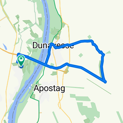
 Kisapostag-Dunavecse 16 km
- Distance
- 21.6 km
- Ascent
- 120 m
- Descent
- 140 m
- Location
- Apostag, Bács-Kiskun county, Hungary
 Túra Kisapostag körül
- Distance
- 11.8 km
- Ascent
- 86 m
- Descent
- 88 m
- Location
- Apostag, Bács-Kiskun county, Hungary
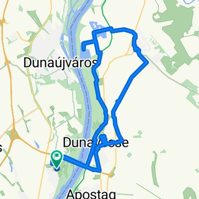
 Dunaújváros to Palánk utca 6., Dunaújváros
- Distance
- 16.6 km
- Ascent
- 200 m
- Descent
- 193 m
- Location
- Apostag, Bács-Kiskun county, Hungary
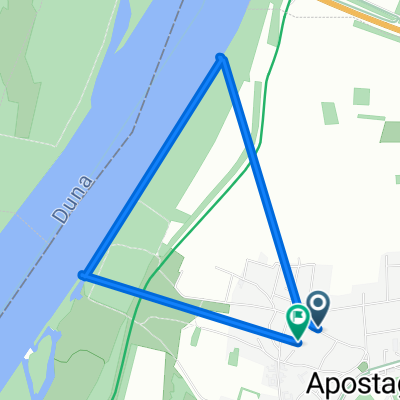
 Bercsényi utca 5, Apostag - Vasmű út 1, Dunaújváros
- Distance
- 13.7 km
- Ascent
- 126 m
- Descent
- 80 m
- Location
- Apostag, Bács-Kiskun county, Hungary
 2015 04 10 Kisapostag - Szalki-bányatavak-41,1
- Distance
- 40 km
- Ascent
- 95 m
- Descent
- 96 m
- Location
- Apostag, Bács-Kiskun county, Hungary
 Táncsics utca - Táncsics utca
- Distance
- 4.5 km
- Ascent
- 11 m
- Descent
- 49 m
- Location
- Apostag, Bács-Kiskun county, Hungary
 2014 11 04 Kisapostag - Dunavecse-2 24,8km
- Distance
- 23.9 km
- Ascent
- 109 m
- Descent
- 107 m
- Location
- Apostag, Bács-Kiskun county, Hungary
 2016 04 03 Kisapostag - Apostag 20 km
- Distance
- 19.6 km
- Ascent
- 104 m
- Descent
- 104 m
- Location
- Apostag, Bács-Kiskun county, Hungary
Open it in the app