

Burgsinn500er
A cycling route starting in Burgsinn, Bavaria, Germany.
Overview
About this route
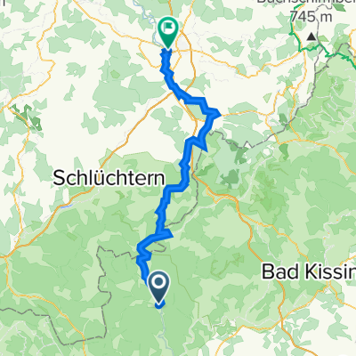
The circular route starting and ending in Burgsinn touches several Northeast Spessart peaks over 500m: Hanauer Berg 513 m - Roßkopf 516 m - Hutsberg 507 m - Waldspitze (near Lohrhaupten) 521 m - Querberg 505 m - Seekopf 520 m - Hermannskoppe 567 m (fourth highest mountain in the Spessart) - Schanzkopf 527 m. Fitting the title, the tour totals 570 m of ascent. My favourite for a Sunday morning ride or as an introductory tour for guests.
- -:--
- Duration
- 39.2 km
- Distance
- 599 m
- Ascent
- 599 m
- Descent
- ---
- Avg. speed
- ---
- Max. altitude

Route quality
Waytypes & surfaces along the route
Waytypes
Track
33 km
(84 %)
Quiet road
1.6 km
(4 %)
Surfaces
Paved
3.9 km
(10 %)
Unpaved
33.3 km
(85 %)
Gravel
20.8 km
(53 %)
Ground
11.4 km
(29 %)
Continue with Bikemap
Use, edit, or download this cycling route
You would like to ride Burgsinn500er or customize it for your own trip? Here is what you can do with this Bikemap route:
Free features
- Save this route as favorite or in collections
- Copy & plan your own version of this route
- Sync your route with Garmin or Wahoo
Premium features
Free trial for 3 days, or one-time payment. More about Bikemap Premium.
- Navigate this route on iOS & Android
- Export a GPX / KML file of this route
- Create your custom printout (try it for free)
- Download this route for offline navigation
Discover more Premium features.
Get Bikemap PremiumFrom our community
Other popular routes starting in Burgsinn
 1. Tag Spessart
- Distance
- 322.7 km
- Ascent
- 2,088 m
- Descent
- 2,090 m
- Location
- Burgsinn, Bavaria, Germany
 Burgsinn - Adelsberg
- Distance
- 26.1 km
- Ascent
- 476 m
- Descent
- 381 m
- Location
- Burgsinn, Bavaria, Germany
 Burgsinn - Fulda
- Distance
- 72.8 km
- Ascent
- 788 m
- Descent
- 716 m
- Location
- Burgsinn, Bavaria, Germany
 Kreuzbergtour
- Distance
- 133.9 km
- Ascent
- 1,253 m
- Descent
- 1,255 m
- Location
- Burgsinn, Bavaria, Germany
 Burgsinn_Grenzüberschreitende_Feierabendrunde
- Distance
- 33.2 km
- Ascent
- 440 m
- Descent
- 440 m
- Location
- Burgsinn, Bavaria, Germany
 Wildsau-Trail und Birkenhainer Straße im Spessart...
- Distance
- 49.5 km
- Ascent
- 854 m
- Descent
- 838 m
- Location
- Burgsinn, Bavaria, Germany
 Auf die Schanz
- Distance
- 46.9 km
- Ascent
- 408 m
- Descent
- 405 m
- Location
- Burgsinn, Bavaria, Germany
 Burgsinn500er
- Distance
- 39.2 km
- Ascent
- 599 m
- Descent
- 599 m
- Location
- Burgsinn, Bavaria, Germany
Open it in the app