
Venetien 1 - Monte Cesen
A cycling route starting in Cavaso del Tomba, Veneto, Italy.
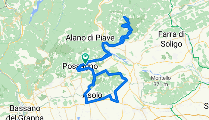
Overview
About this route
Through the vineyards of Valdobbiadene and up to Monte Cesen at 1,570 m.
- -:--
- Duration
- 103.6 km
- Distance
- 1,677 m
- Ascent
- 1,683 m
- Descent
- ---
- Avg. speed
- ---
- Max. altitude

Route quality
Waytypes & surfaces along the route
Waytypes
Road
44.6 km
(43 %)
Path
21.8 km
(21 %)
Surfaces
Paved
21.8 km
(21 %)
Unpaved
19.7 km
(19 %)
Asphalt
21.8 km
(21 %)
Ground
16.6 km
(16 %)
Continue with Bikemap
Use, edit, or download this cycling route
You would like to ride Venetien 1 - Monte Cesen or customize it for your own trip? Here is what you can do with this Bikemap route:
Free features
- Save this route as favorite or in collections
- Copy & plan your own version of this route
- Split it into stages to create a multi-day tour
- Sync your route with Garmin or Wahoo
Premium features
Free trial for 3 days, or one-time payment. More about Bikemap Premium.
- Navigate this route on iOS & Android
- Export a GPX / KML file of this route
- Create your custom printout (try it for free)
- Download this route for offline navigation
Discover more Premium features.
Get Bikemap PremiumFrom our community
Other popular routes starting in Cavaso del Tomba
 Prosecco IV
- Distance
- 85.3 km
- Ascent
- 1,693 m
- Descent
- 1,778 m
- Location
- Cavaso del Tomba, Veneto, Italy
 CAVASO DEL TOMBA
- Distance
- 17.5 km
- Ascent
- 413 m
- Descent
- 413 m
- Location
- Cavaso del Tomba, Veneto, Italy
 Prosecco I
- Distance
- 46.2 km
- Ascent
- 477 m
- Descent
- 501 m
- Location
- Cavaso del Tomba, Veneto, Italy
 Giro 2017 - passo san boldo
- Distance
- 105 km
- Ascent
- 1,771 m
- Descent
- 1,768 m
- Location
- Cavaso del Tomba, Veneto, Italy
 Brevetto del Grappa 05
- Distance
- 22.8 km
- Ascent
- 1,609 m
- Descent
- 145 m
- Location
- Cavaso del Tomba, Veneto, Italy
 Giro 2017 - Monte Grappa
- Distance
- 127.6 km
- Ascent
- 2,698 m
- Descent
- 2,695 m
- Location
- Cavaso del Tomba, Veneto, Italy
 CUROGNA E PONTICELLO (il torrente)
- Distance
- 22.3 km
- Ascent
- 140 m
- Descent
- 276 m
- Location
- Cavaso del Tomba, Veneto, Italy
 Valcavasia by Diego G.
- Distance
- 24 km
- Ascent
- 454 m
- Descent
- 454 m
- Location
- Cavaso del Tomba, Veneto, Italy
Open it in the app