

Heinrichshofen-Nassenhausen
A cycling route starting in Egling, Bavaria, Germany.
Overview
About this route
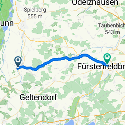
von Heinrichshofen über Steinbach, Eressried, Luttenwang nach Nassenhausen und zurück über Adelshofen, Langwied, Grunertshofen, Steinbach, Dünzelbach
- -:--
- Duration
- 27.5 km
- Distance
- 110 m
- Ascent
- 110 m
- Descent
- ---
- Avg. speed
- ---
- Max. altitude
Route quality
Waytypes & surfaces along the route
Waytypes
Quiet road
23.4 km
(85 %)
Road
3.5 km
(13 %)
Surfaces
Paved
23.3 km
(85 %)
Unpaved
0.2 km
(<1 %)
Asphalt
23.2 km
(85 %)
Gravel
0.2 km
(<1 %)
Continue with Bikemap
Use, edit, or download this cycling route
You would like to ride Heinrichshofen-Nassenhausen or customize it for your own trip? Here is what you can do with this Bikemap route:
Free features
- Save this route as favorite or in collections
- Copy & plan your own version of this route
- Sync your route with Garmin or Wahoo
Premium features
Free trial for 3 days, or one-time payment. More about Bikemap Premium.
- Navigate this route on iOS & Android
- Export a GPX / KML file of this route
- Create your custom printout (try it for free)
- Download this route for offline navigation
Discover more Premium features.
Get Bikemap PremiumFrom our community
Other popular routes starting in Egling
 Am Beerenmoosgraben 17, Geltendorf nach Am Beerenmoosgraben 17, Geltendorf
- Distance
- 19.2 km
- Ascent
- 44 m
- Descent
- 89 m
- Location
- Egling, Bavaria, Germany
 landsberg
- Distance
- 24.5 km
- Ascent
- 40 m
- Descent
- 0 m
- Location
- Egling, Bavaria, Germany
 Familientour Egling - Hofhegnenberg - Baierberg - Mering - zurück entlang Lech
- Distance
- 37.5 km
- Ascent
- 118 m
- Descent
- 121 m
- Location
- Egling, Bavaria, Germany
 Am Beerenmoosgraben 17, Geltendorf nach Am Beerenmoosgraben 17, Geltendorf
- Distance
- 13.6 km
- Ascent
- 35 m
- Descent
- 37 m
- Location
- Egling, Bavaria, Germany
 Heinrichshofen-Nassenhausen
- Distance
- 27.5 km
- Ascent
- 110 m
- Descent
- 110 m
- Location
- Egling, Bavaria, Germany
 Steinbach Runde
- Distance
- 27.4 km
- Ascent
- 110 m
- Descent
- 110 m
- Location
- Egling, Bavaria, Germany
 Hochgeschwindigkeitsroute in Egling an der Paar
- Distance
- 23.2 km
- Ascent
- 122 m
- Descent
- 134 m
- Location
- Egling, Bavaria, Germany
 walles geltendorf St.ottilien kaltenberg
- Distance
- 24.5 km
- Ascent
- 97 m
- Descent
- 96 m
- Location
- Egling, Bavaria, Germany
Open it in the app