

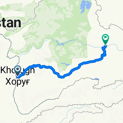
Khorog-M41 junction via Khargush
A cycling route starting in Khorugh, Gorno-Badakhshan, Tajikistan.
Overview
About this route
- -:--
- Duration
- 316 km
- Distance
- 2,725 m
- Ascent
- 973 m
- Descent
- ---
- Avg. speed
- ---
- Max. altitude
Continue with Bikemap
Use, edit, or download this cycling route
You would like to ride Khorog-M41 junction via Khargush or customize it for your own trip? Here is what you can do with this Bikemap route:
Free features
- Save this route as favorite or in collections
- Copy & plan your own version of this route
- Split it into stages to create a multi-day tour
- Sync your route with Garmin or Wahoo
Premium features
Free trial for 3 days, or one-time payment. More about Bikemap Premium.
- Navigate this route on iOS & Android
- Export a GPX / KML file of this route
- Create your custom printout (try it for free)
- Download this route for offline navigation
Discover more Premium features.
Get Bikemap PremiumFrom our community
Other popular routes starting in Khorugh
 Khorog Malvoj 85km
- Distance
- 84.7 km
- Ascent
- 564 m
- Descent
- 254 m
- Location
- Khorugh, Gorno-Badakhshan, Tajikistan
 pamir
pamir- Distance
- 9.8 km
- Ascent
- 1,386 m
- Descent
- 73 m
- Location
- Khorugh, Gorno-Badakhshan, Tajikistan
 Khorog - Osh 1
- Distance
- 313.1 km
- Ascent
- 2,660 m
- Descent
- 1,161 m
- Location
- Khorugh, Gorno-Badakhshan, Tajikistan
 8-KHOROG-ISKASHIM
- Distance
- 103.6 km
- Ascent
- 717 m
- Descent
- 265 m
- Location
- Khorugh, Gorno-Badakhshan, Tajikistan
 Khorog-Murghab
- Distance
- 462.8 km
- Ascent
- 2,890 m
- Descent
- 1,414 m
- Location
- Khorugh, Gorno-Badakhshan, Tajikistan
 pamir1
- Distance
- 536 km
- Ascent
- 3,441 m
- Descent
- 1,896 m
- Location
- Khorugh, Gorno-Badakhshan, Tajikistan
 the Pamir highway, part two
- Distance
- 602 km
- Ascent
- 3,813 m
- Descent
- 5,117 m
- Location
- Khorugh, Gorno-Badakhshan, Tajikistan
 Dunhuang-Khorog
- Distance
- 4,477.7 km
- Ascent
- 11,642 m
- Descent
- 12,597 m
- Location
- Khorugh, Gorno-Badakhshan, Tajikistan
Open it in the app