

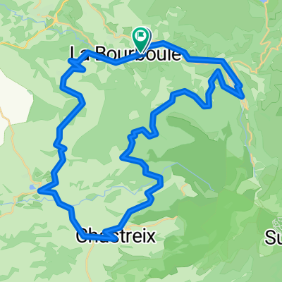
FDm Tour Forgès
A cycling route starting in La Bourboule, Auvergne-Rhône-Alpes, France.
Overview
About this route
- -:--
- Duration
- 132.3 km
- Distance
- 1,034 m
- Ascent
- 1,786 m
- Descent
- ---
- Avg. speed
- ---
- Max. altitude

Route quality
Waytypes & surfaces along the route
Waytypes
Road
63.5 km
(48 %)
Quiet road
27.8 km
(21 %)
Surfaces
Paved
27.8 km
(21 %)
Unpaved
1.3 km
(1 %)
Asphalt
23.8 km
(18 %)
Paved (undefined)
4 km
(3 %)
Continue with Bikemap
Use, edit, or download this cycling route
You would like to ride FDm Tour Forgès or customize it for your own trip? Here is what you can do with this Bikemap route:
Free features
- Save this route as favorite or in collections
- Copy & plan your own version of this route
- Split it into stages to create a multi-day tour
- Sync your route with Garmin or Wahoo
Premium features
Free trial for 3 days, or one-time payment. More about Bikemap Premium.
- Navigate this route on iOS & Android
- Export a GPX / KML file of this route
- Create your custom printout (try it for free)
- Download this route for offline navigation
Discover more Premium features.
Get Bikemap PremiumFrom our community
Other popular routes starting in La Bourboule
 FDm Tour Forgès
- Distance
- 132.3 km
- Ascent
- 1,034 m
- Descent
- 1,786 m
- Location
- La Bourboule, Auvergne-Rhône-Alpes, France
 BOURBOULE croix st robert-lac pavin-chastrex- 97kms
- Distance
- 96.4 km
- Ascent
- 2,001 m
- Descent
- 1,993 m
- Location
- La Bourboule, Auvergne-Rhône-Alpes, France
 chemin 1
- Distance
- 4.8 km
- Ascent
- 199 m
- Descent
- 103 m
- Location
- La Bourboule, Auvergne-Rhône-Alpes, France
 Bourboule 45-700
- Distance
- 44 km
- Ascent
- 671 m
- Descent
- 674 m
- Location
- La Bourboule, Auvergne-Rhône-Alpes, France
 BOURBOULE gorges de courgoul 93kms
- Distance
- 91.8 km
- Ascent
- 1,714 m
- Descent
- 1,714 m
- Location
- La Bourboule, Auvergne-Rhône-Alpes, France
 La Bourboule 60 km 1450 m +
- Distance
- 60 km
- Ascent
- 1,402 m
- Descent
- 1,306 m
- Location
- La Bourboule, Auvergne-Rhône-Alpes, France
 bourboule-mont dore- tour d'auvergne-messeix93kms
- Distance
- 93 km
- Ascent
- 1,268 m
- Descent
- 1,268 m
- Location
- La Bourboule, Auvergne-Rhône-Alpes, France
 BOURBOULE - mont dore-croix morand- chambontour d'auvergne 71km
- Distance
- 71 km
- Ascent
- 1,411 m
- Descent
- 1,408 m
- Location
- La Bourboule, Auvergne-Rhône-Alpes, France
Open it in the app