- 512.1 km
- 2,507 m
- 2,499 m
- Schwedt, Brandenburg, Germany
Die Oderlandschaft vor Schwedt
A cycling route starting in Schwedt, Brandenburg, Germany.
Overview
About this route
The landscape of the Oder polders is splendid. But right next to the Oder, the farm roads are still paved with slabs that have considerably aged. Actually, you can only ride such paths well with a well-sprung bike. Along the Hohensaaten waterway, you ride on a very good bike path. The paths through the polders are also partly slab roads. The surface is not pleasant over long stretches, but the polder landscape is a delight.
- -:--
- Duration
- 62.7 km
- Distance
- 4 m
- Ascent
- 5 m
- Descent
- ---
- Avg. speed
- ---
- Max. altitude
created this 9 years ago
Route quality
Waytypes & surfaces along the route
Waytypes
Track
48.9 km
(78 %)
Access road
5 km
(8 %)
Surfaces
Paved
54.5 km
(87 %)
Unpaved
2.5 km
(4 %)
Asphalt
30.7 km
(49 %)
Concrete
20.1 km
(32 %)
Continue with Bikemap
Use, edit, or download this cycling route
You would like to ride Die Oderlandschaft vor Schwedt or customize it for your own trip? Here is what you can do with this Bikemap route:
Free features
- Save this route as favorite or in collections
- Copy & plan your own version of this route
- Sync your route with Garmin or Wahoo
Premium features
Free trial for 3 days, or one-time payment. More about Bikemap Premium.
- Navigate this route on iOS & Android
- Export a GPX / KML file of this route
- Create your custom printout (try it for free)
- Download this route for offline navigation
Discover more Premium features.
Get Bikemap PremiumFrom our community
Other popular routes starting in Schwedt
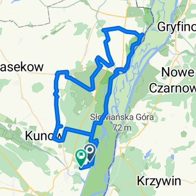
- Von Schwedt/Oder bis Trzcińsko-Zdrój
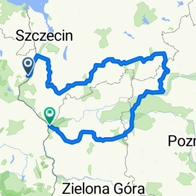
- Am Kniebusch nach Am Kniebusch
- 41.8 km
- 342 m
- 357 m
- Schwedt, Brandenburg, Germany
- Straße Ohne Straßennamen nach Landwiesenweg
- 51.8 km
- 226 m
- 270 m
- Schwedt, Brandenburg, Germany
- Am Kniebusch nach Am Kniebusch
- 18.2 km
- 177 m
- 232 m
- Schwedt, Brandenburg, Germany
- Von Schwedt/Oder bis Trebbin
- 515.7 km
- 2,317 m
- 2,278 m
- Schwedt, Brandenburg, Germany
- Am Kniebusch nach Am Kniebusch
- 15.7 km
- 379 m
- 422 m
- Schwedt, Brandenburg, Germany
- Landwiesenweg nach Ausbau Gatow
- 64 km
- 266 m
- 265 m
- Schwedt, Brandenburg, Germany
- Am Kniebusch nach Am Kniebusch
- 18.1 km
- 79 m
- 124 m
- Schwedt, Brandenburg, Germany
Open it in the app


