

Park Leśników im. Jana Łobodźca
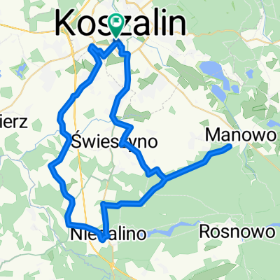
A cycling route starting in Koszalin, West Pomeranian Voivodeship, Poland.
Overview
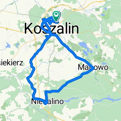
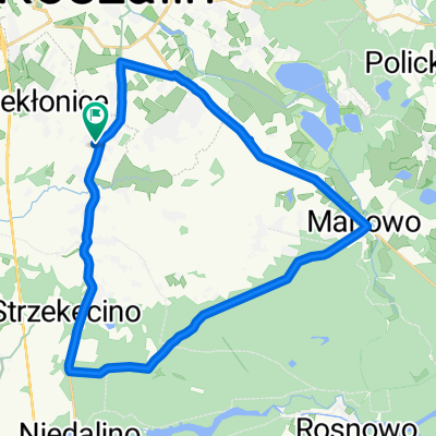
About this route
Park Leśników im. Jana Łobodźca
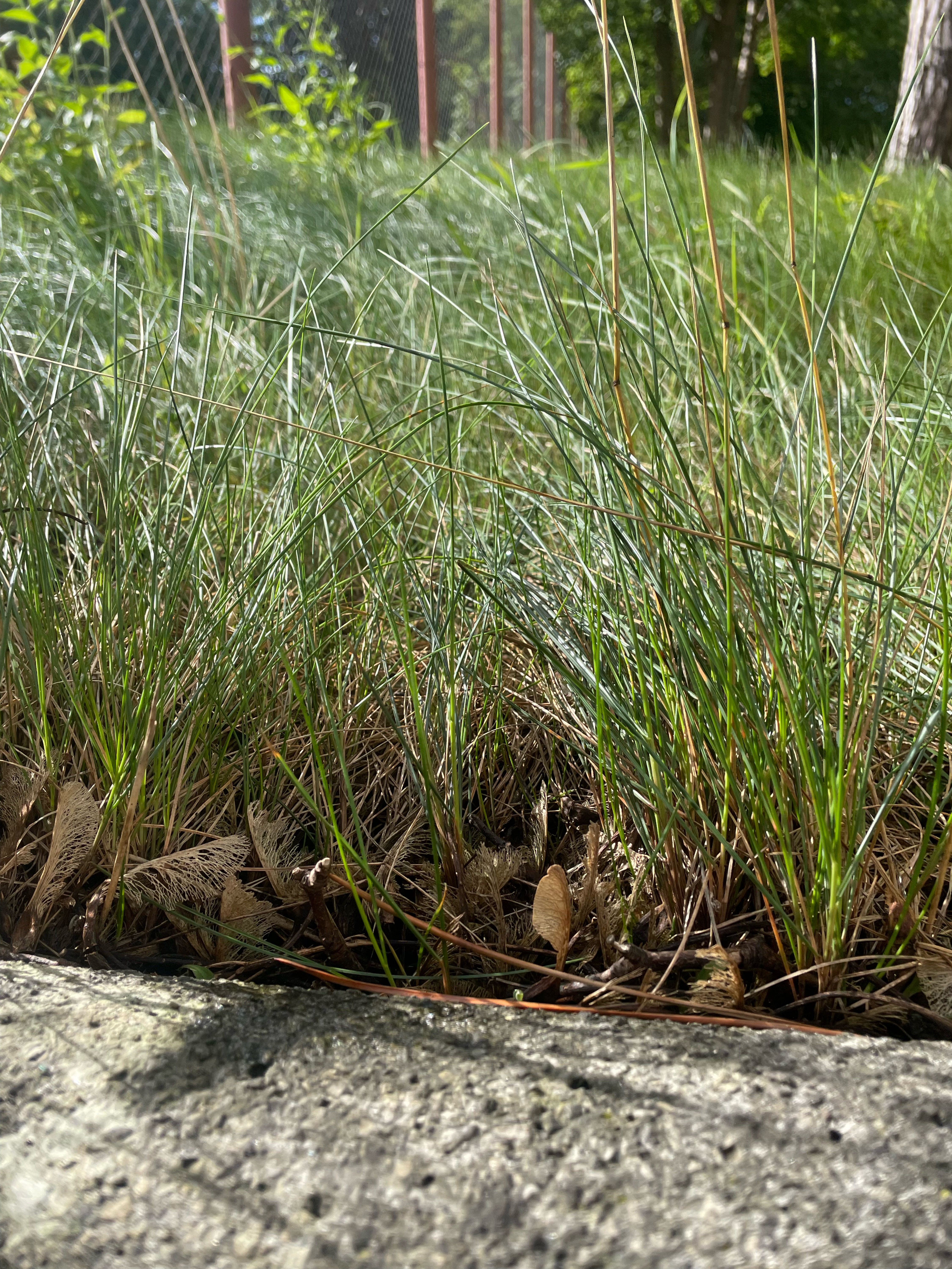
We enter the park through a tall wooden gate with the name of the park. Immediately we see the raked paths. While walking on the next paths, we pass real forest elements of garden architecture; numerous little bridges made with the use of peeled, curved branches, which are already ornate themselves, several pavilions and huts with benches and tables for sitting or sheltering from the rain, a place for a bonfire with prepared wood, even sticks for roasting sausages and a large spatial construction resembling a hunting hide, from which you can see the park from above. An additional attraction are our little streams like natural, small ponds with blooming yellow irises in spring and later with muddy persicaria and bulrushes, and just under the forest lodge there is a quite large pond with a dam, from which water probably flows into the streams.
It is worth noting a several-year-old healthy pedunculate oak growing by a stone, inside a low fence. The words engraved on the boulder inform us that this is an oak called 'papal', because it is one of the hundreds that have grown from acorns blessed by John Paul II during the visit of a delegation of Polish foresters to the Vatican.
Many other attractions and curiosities await us in this park, so it is worth exploring it with family and friends, remembering to behave there culturally and not to leave anything that could reflect poorly on our stay.
Numerous panels that should be read teach us knowledge about nature and forests, as well as how to behave in such a setting.
A place worth seeing, shown to me by Tomek Czajkowski from the Cycling Cooperative Korba from Koszalin. The ride to the park by bike and trailer along forest roads is pleasant, peaceful, and interesting.
- -:--
- Duration
- 56.4 km
- Distance
- 207 m
- Ascent
- 211 m
- Descent
- ---
- Avg. speed
- ---
- Max. altitude

Route quality
Waytypes & surfaces along the route
Waytypes
Track
45.1 km
(80 %)
Quiet road
4.5 km
(8 %)
Surfaces
Paved
28.8 km
(51 %)
Unpaved
27.1 km
(48 %)
Asphalt
25.9 km
(46 %)
Gravel
19.2 km
(34 %)
Continue with Bikemap
Use, edit, or download this cycling route
You would like to ride Park Leśników im. Jana Łobodźca or customize it for your own trip? Here is what you can do with this Bikemap route:
Free features
- Save this route as favorite or in collections
- Copy & plan your own version of this route
- Sync your route with Garmin or Wahoo
Premium features
Free trial for 3 days, or one-time payment. More about Bikemap Premium.
- Navigate this route on iOS & Android
- Export a GPX / KML file of this route
- Create your custom printout (try it for free)
- Download this route for offline navigation
Discover more Premium features.
Get Bikemap PremiumFrom our community
Other popular routes starting in Koszalin
 Szprycha wokół Koszalina - 18.09.2012 r.
- Distance
- 116 km
- Ascent
- 674 m
- Descent
- 676 m
- Location
- Koszalin, West Pomeranian Voivodeship, Poland
 Kolejowa, Köslin nach Bolesława Chrobrego, Mielno
- Distance
- 15.9 km
- Ascent
- 77 m
- Descent
- 109 m
- Location
- Koszalin, West Pomeranian Voivodeship, Poland
 Z klawiatury w Klawisz, Koszalin
- Distance
- 28.9 km
- Ascent
- 104 m
- Descent
- 103 m
- Location
- Koszalin, West Pomeranian Voivodeship, Poland
 Jana Pawła II do Jana Pawła II
- Distance
- 60.3 km
- Ascent
- 330 m
- Descent
- 376 m
- Location
- Koszalin, West Pomeranian Voivodeship, Poland
 Konikowo, Świeszyno do Konikowo, Świeszyno
- Distance
- 31.2 km
- Ascent
- 198 m
- Descent
- 197 m
- Location
- Koszalin, West Pomeranian Voivodeship, Poland
 Route in Koszalin04
- Distance
- 50.9 km
- Ascent
- 216 m
- Descent
- 214 m
- Location
- Koszalin, West Pomeranian Voivodeship, Poland
 Kolejowa, Köslin nach Bolesława Chrobrego, Mielno
- Distance
- 14.7 km
- Ascent
- 163 m
- Descent
- 200 m
- Location
- Koszalin, West Pomeranian Voivodeship, Poland
 Zielona 2, Koszalin do Zielona 1, Koszalin
- Distance
- 20.6 km
- Ascent
- 118 m
- Descent
- 119 m
- Location
- Koszalin, West Pomeranian Voivodeship, Poland
Open it in the app