

Jesuitenweg - (Bayerischen Hiasl)
A cycling route starting in Friedberg, Bavaria, Germany.
Overview
About this route
After cycling (Regio Augsburg Tourism)
- -:--
- Duration
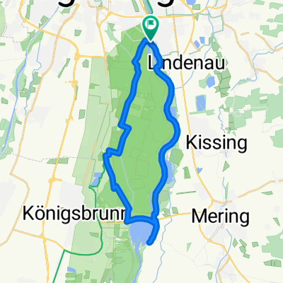
- 22.8 km
- Distance
- 138 m
- Ascent
- 140 m
- Descent
- ---
- Avg. speed
- ---
- Max. altitude
Route quality
Waytypes & surfaces along the route
Waytypes
Quiet road
8.7 km
(38 %)
Path
5.5 km
(24 %)
Surfaces
Paved
16.2 km
(71 %)
Unpaved
5.9 km
(26 %)
Asphalt
16 km
(70 %)
Gravel
5.3 km
(23 %)
Continue with Bikemap
Use, edit, or download this cycling route
You would like to ride Jesuitenweg - (Bayerischen Hiasl) or customize it for your own trip? Here is what you can do with this Bikemap route:
Free features
- Save this route as favorite or in collections
- Copy & plan your own version of this route
- Sync your route with Garmin or Wahoo
Premium features
Free trial for 3 days, or one-time payment. More about Bikemap Premium.
- Navigate this route on iOS & Android
- Export a GPX / KML file of this route
- Create your custom printout (try it for free)
- Download this route for offline navigation
Discover more Premium features.
Get Bikemap PremiumFrom our community
Other popular routes starting in Friedberg
 Mountainbikerunde mit Waldtrails
- Distance
- 40.5 km
- Ascent
- 379 m
- Descent
- 379 m
- Location
- Friedberg, Bavaria, Germany
 Kirchenroute FDB-Süd
- Distance
- 27 km
- Ascent
- 150 m
- Descent
- 150 m
- Location
- Friedberg, Bavaria, Germany
 Friedberger Osten
- Distance
- 25.4 km
- Ascent
- 238 m
- Descent
- 241 m
- Location
- Friedberg, Bavaria, Germany
 Jesuitenweg - (Bayerischen Hiasl)
- Distance
- 22.8 km
- Ascent
- 138 m
- Descent
- 140 m
- Location
- Friedberg, Bavaria, Germany
 Lechtrails
- Distance
- 44.5 km
- Ascent
- 135 m
- Descent
- 135 m
- Location
- Friedberg, Bavaria, Germany
 Neue Badetour
- Distance
- 25.1 km
- Ascent
- 84 m
- Descent
- 84 m
- Location
- Friedberg, Bavaria, Germany
 Rund um Augsburg
- Distance
- 54.9 km
- Ascent
- 429 m
- Descent
- 445 m
- Location
- Friedberg, Bavaria, Germany
 Relaxed Freitag Ride In Augsburg
- Distance
- 29.1 km
- Ascent
- 538 m
- Descent
- 485 m
- Location
- Friedberg, Bavaria, Germany
Open it in the app