

Z 04c - Slovenské rudohorie
A cycling route starting in Gelnica, Košice Region, Slovakia.
Overview
About this route
Through the number of monuments
- -:--
- Duration
- 210.8 km
- Distance
- 2,361 m
- Ascent
- 2,362 m
- Descent
- ---
- Avg. speed
- ---
- Max. altitude

Route quality
Waytypes & surfaces along the route
Waytypes
Road
40.1 km
(19 %)
Quiet road
40.1 km
(19 %)
Surfaces
Paved
75.9 km
(36 %)
Unpaved
31.6 km
(15 %)
Asphalt
75.9 km
(36 %)
Gravel
12.7 km
(6 %)
Route highlights
Points of interest along the route
Point of interest after 1.1 km
Ružín
Point of interest after 27.8 km
Kojšova hoľa
Point of interest after 48.2 km
Jasovský kláštor
Point of interest after 56.5 km
Medzev hámor
Point of interest after 61.3 km
Hámor Šugov
Point of interest after 68.4 km
Ubytovanie Penzion Stary Mlyn
Point of interest after 75.7 km
Námestie Moldava nad Bodvou
Point of interest after 92 km
Turniansky hrad
Point of interest after 99.1 km
Zádielská dolina
Point of interest after 101.9 km
Zádielská chata
Point of interest after 111.4 km
Husitský opevnený kostol
Point of interest after 125.1 km
Ubytovanie Sedliacky dom
Point of interest after 128.5 km
Hrad Krásna Hôrka
Point of interest after 135.3 km
Rožňava námestie
Point of interest after 141 km
Vysoká pec Nižná Slaná
Point of interest after 141 km
Štítnický hrad
Point of interest after 141.8 km
Kaštieľ Betliar
Point of interest after 200.9 km
Gelnický hrad
Continue with Bikemap
Use, edit, or download this cycling route
You would like to ride Z 04c - Slovenské rudohorie or customize it for your own trip? Here is what you can do with this Bikemap route:
Free features
- Save this route as favorite or in collections
- Copy & plan your own version of this route
- Split it into stages to create a multi-day tour
- Sync your route with Garmin or Wahoo
Premium features
Free trial for 3 days, or one-time payment. More about Bikemap Premium.
- Navigate this route on iOS & Android
- Export a GPX / KML file of this route
- Create your custom printout (try it for free)
- Download this route for offline navigation
Discover more Premium features.
Get Bikemap PremiumFrom our community
Other popular routes starting in Gelnica
 Z Folkmára do Jakloviec okľukou :o)
- Distance
- 24 km
- Ascent
- 812 m
- Descent
- 692 m
- Location
- Gelnica, Košice Region, Slovakia
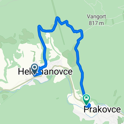 Helcmanovce-Prakovce (naokolo bližšie :-))
- Distance
- 8.2 km
- Ascent
- 341 m
- Descent
- 337 m
- Location
- Gelnica, Košice Region, Slovakia
 My favorite
- Distance
- 16 km
- Ascent
- 808 m
- Descent
- 803 m
- Location
- Gelnica, Košice Region, Slovakia
 Singláč nad Ružínom - začiatok...
- Distance
- 3 km
- Ascent
- 87 m
- Descent
- 259 m
- Location
- Gelnica, Košice Region, Slovakia
 Helcmanovce-"Letisko"-Mníšek nad Hnilcom motocross areál-Helcmanovce
- Distance
- 17.9 km
- Ascent
- 540 m
- Descent
- 542 m
- Location
- Gelnica, Košice Region, Slovakia
 Gelnica-Cechy-Thurzov-Chata Olympia-Helcmanovce
- Distance
- 14.6 km
- Ascent
- 522 m
- Descent
- 731 m
- Location
- Gelnica, Košice Region, Slovakia
 Jakľofski bicigeľ 2016
- Distance
- 30 km
- Ascent
- 927 m
- Descent
- 931 m
- Location
- Gelnica, Košice Region, Slovakia
 Helcmanovce- Kloptaň- Smolnícka píla
- Distance
- 25 km
- Ascent
- 686 m
- Descent
- 689 m
- Location
- Gelnica, Košice Region, Slovakia
Open it in the app