

Nöggenschwiel - Biberach
A cycling route starting in Weilheim, Baden-Wurttemberg, Germany.
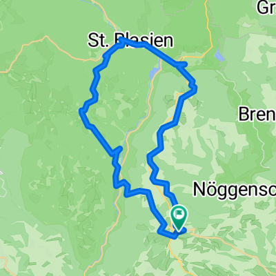
Overview
About this route
Route to the Wood Competence Center
Leipzigstraße 21, 88400 Biberach an der Riß
- -:--
- Duration
- 164 km
- Distance
- 689 m
- Ascent
- 875 m
- Descent
- ---
- Avg. speed
- ---
- Max. altitude

Route quality
Waytypes & surfaces along the route
Waytypes
Quiet road
45.9 km
(28 %)
Road
34.4 km
(21 %)
Surfaces
Paved
131.2 km
(80 %)
Unpaved
1.6 km
(1 %)
Asphalt
121.3 km
(74 %)
Paved (undefined)
9.8 km
(6 %)
Continue with Bikemap
Use, edit, or download this cycling route
You would like to ride Nöggenschwiel - Biberach or customize it for your own trip? Here is what you can do with this Bikemap route:
Free features
- Save this route as favorite or in collections
- Copy & plan your own version of this route
- Split it into stages to create a multi-day tour
- Sync your route with Garmin or Wahoo
Premium features
Free trial for 3 days, or one-time payment. More about Bikemap Premium.
- Navigate this route on iOS & Android
- Export a GPX / KML file of this route
- Create your custom printout (try it for free)
- Download this route for offline navigation
Discover more Premium features.
Get Bikemap PremiumFrom our community
Other popular routes starting in Weilheim
 St.Blasien
- Distance
- 33.6 km
- Ascent
- 968 m
- Descent
- 969 m
- Location
- Weilheim, Baden-Wurttemberg, Germany
 Gurtweil, Schlüchttal, Ühlingen, Bettmaringen, Steinatal, Gurtweil
- Distance
- 49 km
- Ascent
- 1,283 m
- Descent
- 1,280 m
- Location
- Weilheim, Baden-Wurttemberg, Germany
 Route Nöggenschwiel Unteralpfen
- Distance
- 25.1 km
- Ascent
- 333 m
- Descent
- 334 m
- Location
- Weilheim, Baden-Wurttemberg, Germany
 Nöggenschwiel - Biberach
- Distance
- 164 km
- Ascent
- 689 m
- Descent
- 875 m
- Location
- Weilheim, Baden-Wurttemberg, Germany
 Fohrenbachtal
- Distance
- 28.5 km
- Ascent
- 635 m
- Descent
- 653 m
- Location
- Weilheim, Baden-Wurttemberg, Germany
 Weilheim-Freiburg
- Distance
- 83.3 km
- Ascent
- 1,539 m
- Descent
- 1,826 m
- Location
- Weilheim, Baden-Wurttemberg, Germany
 Mai Tour ;-)
- Distance
- 43 km
- Ascent
- 577 m
- Descent
- 572 m
- Location
- Weilheim, Baden-Wurttemberg, Germany
 Gurtweil nach Laufenburg u. zurück
- Distance
- 47.9 km
- Ascent
- 210 m
- Descent
- 212 m
- Location
- Weilheim, Baden-Wurttemberg, Germany
Open it in the app