

2016_6_Königssee - Bodensee (Nesselwang - Hergatz)
A cycling route starting in Nesselwang, Bavaria, Germany.
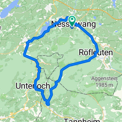
Overview
About this route
Day 6 (85 km / 1004 m elevation gain)
via Oy-Mittelberg - Immenstadt - Oberstaufen
- -:--
- Duration
- 85 km
- Distance
- 409 m
- Ascent
- 729 m
- Descent
- ---
- Avg. speed
- ---
- Max. altitude

Route quality
Waytypes & surfaces along the route
Waytypes
Quiet road
51 km
(60 %)
Road
11.9 km
(14 %)
Surfaces
Paved
79 km
(93 %)
Unpaved
1.7 km
(2 %)
Asphalt
78.2 km
(92 %)
Paved (undefined)
0.8 km
(1 %)
Continue with Bikemap
Use, edit, or download this cycling route
You would like to ride 2016_6_Königssee - Bodensee (Nesselwang - Hergatz) or customize it for your own trip? Here is what you can do with this Bikemap route:
Free features
- Save this route as favorite or in collections
- Copy & plan your own version of this route
- Split it into stages to create a multi-day tour
- Sync your route with Garmin or Wahoo
Premium features
Free trial for 3 days, or one-time payment. More about Bikemap Premium.
- Navigate this route on iOS & Android
- Export a GPX / KML file of this route
- Create your custom printout (try it for free)
- Download this route for offline navigation
Discover more Premium features.
Get Bikemap PremiumFrom our community
Other popular routes starting in Nesselwang
 2 Drei-Täler-Radtour Allgäu-Tirol
- Distance
- 66.8 km
- Ascent
- 590 m
- Descent
- 590 m
- Location
- Nesselwang, Bavaria, Germany
 Allgäu- Tannheimer Tal
- Distance
- 79.6 km
- Ascent
- 846 m
- Descent
- 851 m
- Location
- Nesselwang, Bavaria, Germany
 Stubentalalm
- Distance
- 22.6 km
- Ascent
- 519 m
- Descent
- 519 m
- Location
- Nesselwang, Bavaria, Germany
 Allgäus Trails
- Distance
- 25.2 km
- Ascent
- 1,128 m
- Descent
- 1,116 m
- Location
- Nesselwang, Bavaria, Germany
 Die schöne Allgäuerin
- Distance
- 90.6 km
- Ascent
- 983 m
- Descent
- 983 m
- Location
- Nesselwang, Bavaria, Germany
 Nesselwang - Schlossberg-Alm - Schwaltenweiher - Attlesee
- Distance
- 27.1 km
- Ascent
- 384 m
- Descent
- 390 m
- Location
- Nesselwang, Bavaria, Germany
 Ins benachbarte Tannheimer Tal
- Distance
- 41.4 km
- Ascent
- 349 m
- Descent
- 347 m
- Location
- Nesselwang, Bavaria, Germany
 Nesselwang - Wertachtal - Schwarzenberg - Seemoos - Maria Rain
- Distance
- 21.9 km
- Ascent
- 529 m
- Descent
- 532 m
- Location
- Nesselwang, Bavaria, Germany
Open it in the app