

Across Canada Trails - Proposed Paved Route - Cranbrook to Fernie, BC
A cycling route starting in Cranbrook, British Columbia, Canada.
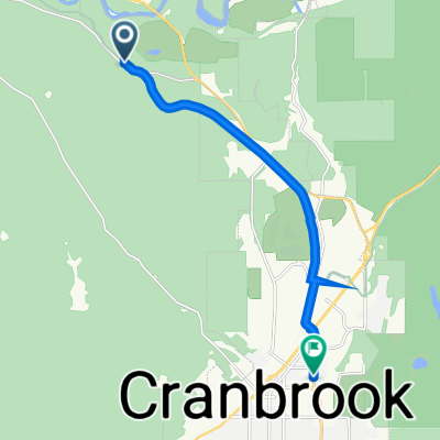
Overview
About this route
In Cranbrook there is a rotary route to follow (that has not been mapped on OpenCycleMap yet.)
Fort Steele is recommended to visit
There is a road on the other side of the river (it just hasn't been mapped yet)
And there is camping at the provincial park at the southern part of this route
- -:--
- Duration
- 109.1 km
- Distance
- 1,278 m
- Ascent
- 1,207 m
- Descent
- ---
- Avg. speed
- ---
- Max. altitude
Continue with Bikemap
Use, edit, or download this cycling route
You would like to ride Across Canada Trails - Proposed Paved Route - Cranbrook to Fernie, BC or customize it for your own trip? Here is what you can do with this Bikemap route:
Free features
- Save this route as favorite or in collections
- Copy & plan your own version of this route
- Split it into stages to create a multi-day tour
- Sync your route with Garmin or Wahoo
Premium features
Free trial for 3 days, or one-time payment. More about Bikemap Premium.
- Navigate this route on iOS & Android
- Export a GPX / KML file of this route
- Create your custom printout (try it for free)
- Download this route for offline navigation
Discover more Premium features.
Get Bikemap PremiumFrom our community
Other popular routes starting in Cranbrook
 Medio Fondo
- Distance
- 102 km
- Ascent
- 717 m
- Descent
- 717 m
- Location
- Cranbrook, British Columbia, Canada
 hgjhvv
- Distance
- 8.9 km
- Ascent
- 75 m
- Descent
- 68 m
- Location
- Cranbrook, British Columbia, Canada
 Interm (proposed) regional cycle route Cranbrook to Kimberly, BC
- Distance
- 27.8 km
- Ascent
- 370 m
- Descent
- 147 m
- Location
- Cranbrook, British Columbia, Canada
 21 Avenue North 252, Cranbrook to V1A, Kimberley
- Distance
- 33.5 km
- Ascent
- 896 m
- Descent
- 558 m
- Location
- Cranbrook, British Columbia, Canada
 Across Canada Trails - Proposed Paved Route - Cranbrook to Fernie, BC
- Distance
- 109.1 km
- Ascent
- 1,278 m
- Descent
- 1,207 m
- Location
- Cranbrook, British Columbia, Canada
 Option 2 Cranbrook -Creston
- Distance
- 109.5 km
- Ascent
- 437 m
- Descent
- 708 m
- Location
- Cranbrook, British Columbia, Canada
 CranbrookRailTrailMissionWycliffeLoop CLONED FROM ROUTE 531251
- Distance
- 28 km
- Ascent
- 271 m
- Descent
- 269 m
- Location
- Cranbrook, British Columbia, Canada
 Can11 Cranbrook Sparwood
- Distance
- 132.4 km
- Ascent
- 603 m
- Descent
- 382 m
- Location
- Cranbrook, British Columbia, Canada
Open it in the app