

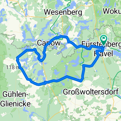
Stechlinsee - Menz - Feldgrieben - Zechliner Hütte - Carnow- Wustrow - Johannesruh
A cycling route starting in Fürstenberg, Brandenburg, Germany.
Overview
About this route
Poor signage led to detours and sandy paths in the first section. From Zechliner Hut to Wustrow, good path conditions. From Wustrow to Johannesruh, poor path conditions. No significant climbs. Ridden by 7 pensioners.
- -:--
- Duration
- 39.8 km
- Distance
- 166 m
- Ascent
- 169 m
- Descent
- ---
- Avg. speed
- ---
- Max. altitude
Route quality
Waytypes & surfaces along the route
Waytypes
Track
14.3 km
(36 %)
Path
13.5 km
(34 %)
Surfaces
Paved
16.7 km
(42 %)
Unpaved
20.7 km
(52 %)
Asphalt
16.3 km
(41 %)
Gravel
7.2 km
(18 %)
Continue with Bikemap
Use, edit, or download this cycling route
You would like to ride Stechlinsee - Menz - Feldgrieben - Zechliner Hütte - Carnow- Wustrow - Johannesruh or customize it for your own trip? Here is what you can do with this Bikemap route:
Free features
- Save this route as favorite or in collections
- Copy & plan your own version of this route
- Sync your route with Garmin or Wahoo
Premium features
Free trial for 3 days, or one-time payment. More about Bikemap Premium.
- Navigate this route on iOS & Android
- Export a GPX / KML file of this route
- Create your custom printout (try it for free)
- Download this route for offline navigation
Discover more Premium features.
Get Bikemap PremiumFrom our community
Other popular routes starting in Fürstenberg
 perm Rheinsberger-Fürstenberger-Seentour
- Distance
- 78.3 km
- Ascent
- 399 m
- Descent
- 384 m
- Location
- Fürstenberg, Brandenburg, Germany
 Durch kühle Buchenwälder
- Distance
- 37.8 km
- Ascent
- 346 m
- Descent
- 347 m
- Location
- Fürstenberg, Brandenburg, Germany
 Berlin Kopenhagen Teil 5 -Neustrelitz- 57km
- Distance
- 56.7 km
- Ascent
- 191 m
- Descent
- 173 m
- Location
- Fürstenberg, Brandenburg, Germany
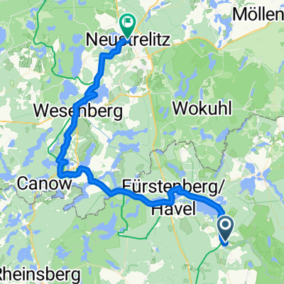
 Furstenberg/ Havel to Neustrelitz
- Distance
- 22.6 km
- Ascent
- 119 m
- Descent
- 102 m
- Location
- Fürstenberg, Brandenburg, Germany
 Seen Tour-de-McPommes '16
- Distance
- 266.9 km
- Ascent
- 168 m
- Descent
- 168 m
- Location
- Fürstenberg, Brandenburg, Germany
 Tag 2: Fürstenberg -> Oranienburg
- Distance
- 78.9 km
- Ascent
- 104 m
- Descent
- 126 m
- Location
- Fürstenberg, Brandenburg, Germany
 Kanu Steinhavelmühle - Waren
- Distance
- 77.7 km
- Ascent
- 41 m
- Descent
- 37 m
- Location
- Fürstenberg, Brandenburg, Germany
 Rheinsberger Seenland
- Distance
- 56.7 km
- Ascent
- 229 m
- Descent
- 229 m
- Location
- Fürstenberg, Brandenburg, Germany
Open it in the app