

Naramata Routes
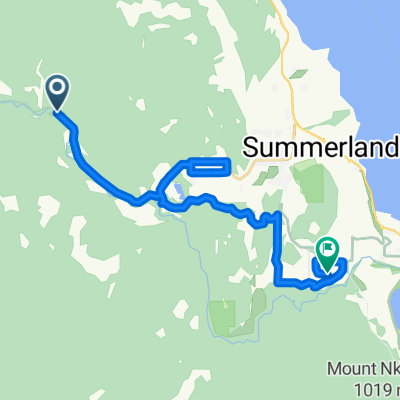
N - S - Naramata Leg Warmer
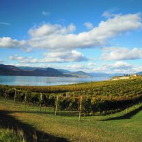
A cycling route starting in Summerland, British Columbia, Canada.
Overview
About this route
- -:--
- Duration
- 30.8 km
- Distance
- 325 m
- Ascent
- 325 m
- Descent
- ---
- Avg. speed
- ---
- Max. altitude

Part of
Naramata Routes
3 stages
Route quality
Waytypes & surfaces along the route
Waytypes
Quiet road
10.5 km
(34 %)
Cycleway
4 km
(13 %)
Surfaces
Paved
6.2 km
(20 %)
Unpaved
7.4 km
(24 %)
Asphalt
6.2 km
(20 %)
Gravel
4 km
(13 %)
Continue with Bikemap
Use, edit, or download this cycling route
You would like to ride N - S - Naramata Leg Warmer or customize it for your own trip? Here is what you can do with this Bikemap route:
Free features
- Save this route as favorite or in collections
- Copy & plan your own version of this route
- Sync your route with Garmin or Wahoo
Premium features
Free trial for 3 days, or one-time payment. More about Bikemap Premium.
- Navigate this route on iOS & Android
- Export a GPX / KML file of this route
- Create your custom printout (try it for free)
- Download this route for offline navigation
Discover more Premium features.
Get Bikemap PremiumFrom our community
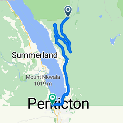
Other popular routes starting in Summerland
 KVR - Summerland to Hope
- Distance
- 250.4 km
- Ascent
- 1,095 m
- Descent
- 1,575 m
- Location
- Summerland, British Columbia, Canada
 Summerland KVR-TCT
- Distance
- 21.4 km
- Ascent
- 304 m
- Descent
- 493 m
- Location
- Summerland, British Columbia, Canada
 Glenfir - Naramata - Penticton - Kaleden - OK Falls
- Distance
- 48.4 km
- Ascent
- 146 m
- Descent
- 578 m
- Location
- Summerland, British Columbia, Canada
 N - S - Naramata Leg Warmer
- Distance
- 30.8 km
- Ascent
- 325 m
- Descent
- 325 m
- Location
- Summerland, British Columbia, Canada
 S - S - Bottleneck Drive - Casual
- Distance
- 29.9 km
- Ascent
- 256 m
- Descent
- 339 m
- Location
- Summerland, British Columbia, Canada
 N - L - Naramata Loop
- Distance
- 79.1 km
- Ascent
- 1,510 m
- Descent
- 1,510 m
- Location
- Summerland, British Columbia, Canada
 12-09-14 Kanada: Chute Lake Resort (Kettle Valley Rail Trail)-Penticton
- Distance
- 39.6 km
- Ascent
- 19 m
- Descent
- 819 m
- Location
- Summerland, British Columbia, Canada
 Chute Lake - Poplar Grove KVR
- Distance
- 39.1 km
- Ascent
- 71 m
- Descent
- 873 m
- Location
- Summerland, British Columbia, Canada
Open it in the app