

TransAmerica Trail Section 4/5
A cycling route starting in Missoula, Montana, United States.
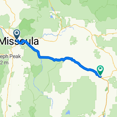
Overview
About this route
Missoula - West Yellowstone - Rawlins
- -:--
- Duration
- 1,203.2 km
- Distance
- 4,348 m
- Ascent
- 3,279 m
- Descent
- ---
- Avg. speed
- ---
- Max. altitude

Route quality
Waytypes & surfaces along the route
Waytypes
Cycleway
336.9 km
(28 %)
Track
84.2 km
(7 %)
Surfaces
Paved
505.4 km
(42 %)
Unpaved
36.1 km
(3 %)
Asphalt
361 km
(30 %)
Paved (undefined)
144.4 km
(12 %)
Continue with Bikemap
Use, edit, or download this cycling route
You would like to ride TransAmerica Trail Section 4/5 or customize it for your own trip? Here is what you can do with this Bikemap route:
Free features
- Save this route as favorite or in collections
- Copy & plan your own version of this route
- Split it into stages to create a multi-day tour
- Sync your route with Garmin or Wahoo
Premium features
Free trial for 3 days, or one-time payment. More about Bikemap Premium.
- Navigate this route on iOS & Android
- Export a GPX / KML file of this route
- Create your custom printout (try it for free)
- Download this route for offline navigation
Discover more Premium features.
Get Bikemap PremiumFrom our community
Other popular routes starting in Missoula
 Missoula-Frenchtown Circle
- Distance
- 53.9 km
- Ascent
- 133 m
- Descent
- 133 m
- Location
- Missoula, Montana, United States
 Colfax WA to Klickitat St
- Distance
- 1,114.3 km
- Ascent
- 15,830 m
- Descent
- 16,768 m
- Location
- Missoula, Montana, United States
 Lag 2
Lag 2- Distance
- 1,962.8 km
- Ascent
- 2,564 m
- Descent
- 3,271 m
- Location
- Missoula, Montana, United States
 West Greenough Drive 2020, Missoula to West Greenough Drive 2020, Missoula
- Distance
- 9.8 km
- Ascent
- 72 m
- Descent
- 72 m
- Location
- Missoula, Montana, United States
 Day 9
Day 9- Distance
- 117.9 km
- Ascent
- 390 m
- Descent
- 51 m
- Location
- Missoula, Montana, United States
 Moderate route in Missoula
- Distance
- 27 km
- Ascent
- 70 m
- Descent
- 73 m
- Location
- Missoula, Montana, United States
 Missoula to Helena
- Distance
- 200.8 km
- Ascent
- 1,235 m
- Descent
- 991 m
- Location
- Missoula, Montana, United States
 Easy ride in Missoula
- Distance
- 29.3 km
- Ascent
- 758 m
- Descent
- 756 m
- Location
- Missoula, Montana, United States
Open it in the app