

Eichgraben-Hochstrass
A cycling route starting in Eichgraben, Lower Austria, Austria.
Overview
About this route
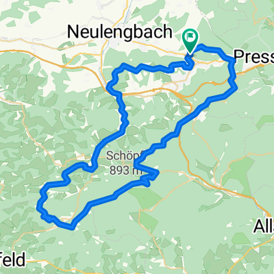
Pleasant circular route from the Eichgraben swimming pool via Finsterleiten to Hochstrass and back for 1.5 hours of fun, about 30% gravel and hiking trails.
For experienced bikers, an absolutely rewarding diversion from Dürrwienstraße to Hochstrass on the hiking path to Jochgraben/Schöpfel with a challenging steep section. After rainfall, pushing is required.
The efforts of the climb are rewarded with a brisk descent from Hochstrass to Eichgraben.
- -:--
- Duration
- 21.1 km
- Distance
- 520 m
- Ascent
- 520 m
- Descent
- ---
- Avg. speed
- ---
- Max. altitude
Continue with Bikemap
Use, edit, or download this cycling route
You would like to ride Eichgraben-Hochstrass or customize it for your own trip? Here is what you can do with this Bikemap route:
Free features
- Save this route as favorite or in collections
- Copy & plan your own version of this route
- Sync your route with Garmin or Wahoo
Premium features
Free trial for 3 days, or one-time payment. More about Bikemap Premium.
- Navigate this route on iOS & Android
- Export a GPX / KML file of this route
- Create your custom printout (try it for free)
- Download this route for offline navigation
Discover more Premium features.
Get Bikemap PremiumFrom our community
Other popular routes starting in Eichgraben
 Brombeerstraße 24, Eichgraben nach Hauptstraße 3, Wolfsgraben
- Distance
- 15.6 km
- Ascent
- 127 m
- Descent
- 232 m
- Location
- Eichgraben, Lower Austria, Austria
 kurz runderl bad
- Distance
- 12.8 km
- Ascent
- 347 m
- Descent
- 347 m
- Location
- Eichgraben, Lower Austria, Austria
 Schöpfltour
- Distance
- 33.4 km
- Ascent
- 1,017 m
- Descent
- 1,017 m
- Location
- Eichgraben, Lower Austria, Austria
 Rekawinkel - Wien OSV
- Distance
- 30.1 km
- Ascent
- 543 m
- Descent
- 632 m
- Location
- Eichgraben, Lower Austria, Austria
 Schöpfltour
- Distance
- 33.4 km
- Ascent
- 1,015 m
- Descent
- 1,015 m
- Location
- Eichgraben, Lower Austria, Austria
 Rekawinkel-Neulengbach-Tulln-Klosterneuburg-Thalia
- Distance
- 73.8 km
- Ascent
- 77 m
- Descent
- 234 m
- Location
- Eichgraben, Lower Austria, Austria
 Kleine Schöpfelrunde
- Distance
- 48.1 km
- Ascent
- 887 m
- Descent
- 890 m
- Location
- Eichgraben, Lower Austria, Austria
 Grosse Schoepflrunde
- Distance
- 61.6 km
- Ascent
- 1,223 m
- Descent
- 1,225 m
- Location
- Eichgraben, Lower Austria, Austria
Open it in the app