

🚴♀️E*Bike🇮🇩 Sterzing - Tschötsch
A cycling route starting in Racines - Ratschings, Trentino-Alto Adige, Italy.
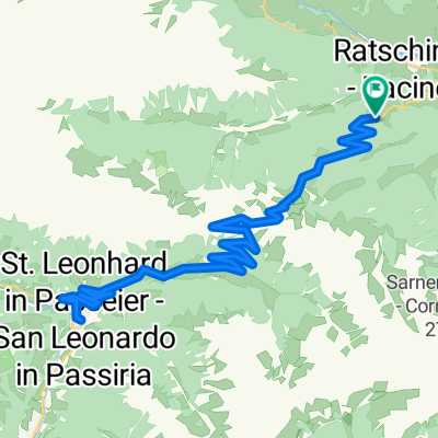
Overview
About this route
TEASI track
- -:--
- Duration
- 46.1 km
- Distance
- 186 m
- Ascent
- 567 m
- Descent
- ---
- Avg. speed
- ---
- Max. altitude

Route photos


Route quality
Waytypes & surfaces along the route
Waytypes
Cycleway
13.8 km
(30 %)
Quiet road
10.6 km
(23 %)
Surfaces
Paved
34.6 km
(75 %)
Unpaved
4.2 km
(9 %)
Asphalt
33.7 km
(73 %)
Gravel
2.3 km
(5 %)
Continue with Bikemap
Use, edit, or download this cycling route
You would like to ride 🚴♀️E*Bike🇮🇩 Sterzing - Tschötsch or customize it for your own trip? Here is what you can do with this Bikemap route:
Free features
- Save this route as favorite or in collections
- Copy & plan your own version of this route
- Sync your route with Garmin or Wahoo
Premium features
Free trial for 3 days, or one-time payment. More about Bikemap Premium.
- Navigate this route on iOS & Android
- Export a GPX / KML file of this route
- Create your custom printout (try it for free)
- Download this route for offline navigation
Discover more Premium features.
Get Bikemap PremiumFrom our community
Other popular routes starting in Racines - Ratschings
 Alpen 2014 - Tag 2
- Distance
- 125 km
- Ascent
- 2,106 m
- Descent
- 1,880 m
- Location
- Racines - Ratschings, Trentino-Alto Adige, Italy
 Jaufenpass
- Distance
- 33.9 km
- Ascent
- 1,051 m
- Descent
- 1,054 m
- Location
- Racines - Ratschings, Trentino-Alto Adige, Italy
 Trans Alp 2013 - Psycho Cross - Etappe 3
- Distance
- 49.9 km
- Ascent
- 2,297 m
- Descent
- 1,643 m
- Location
- Racines - Ratschings, Trentino-Alto Adige, Italy
 Casateia - Calice - 11
- Distance
- 9.7 km
- Ascent
- 468 m
- Descent
- 479 m
- Location
- Racines - Ratschings, Trentino-Alto Adige, Italy
 2020-06-11
- Distance
- 20.5 km
- Ascent
- 187 m
- Descent
- 197 m
- Location
- Racines - Ratschings, Trentino-Alto Adige, Italy
 Stange RatschingserHof - Obertelfes - Mareit - Stange
- Distance
- 12.9 km
- Ascent
- 358 m
- Descent
- 289 m
- Location
- Racines - Ratschings, Trentino-Alto Adige, Italy
 Jaufenpassrunde
- Distance
- 56.2 km
- Ascent
- 2,018 m
- Descent
- 2,018 m
- Location
- Racines - Ratschings, Trentino-Alto Adige, Italy
 🚴♀️E*Bike🇮🇩 Sterzing - Tschötsch
- Distance
- 46.1 km
- Ascent
- 186 m
- Descent
- 567 m
- Location
- Racines - Ratschings, Trentino-Alto Adige, Italy
Open it in the app