

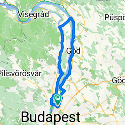
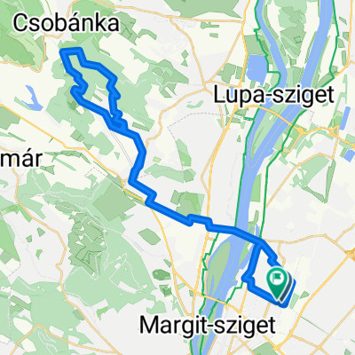
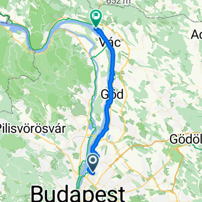
Budakalász (Lupa átkelő)
A cycling route starting in Budapest XIII. kerület, Budapest, Hungary.
Overview
About this route
I might point out that the images were taken in the area of the Lupa island ferry at a water level of 385 cm in Budapest. The Danube promenade is already passable.
- -:--
- Duration
- 27.1 km
- Distance
- 33 m
- Ascent
- 36 m
- Descent
- ---
- Avg. speed
- ---
- Max. altitude

Route quality
Waytypes & surfaces along the route
Waytypes
Cycleway
11.9 km
(44 %)
Quiet road
3.8 km
(14 %)
Surfaces
Paved
23.1 km
(85 %)
Unpaved
0.8 km
(3 %)
Asphalt
20.9 km
(77 %)
Concrete
1.6 km
(6 %)
Route highlights
Points of interest along the route
\"")
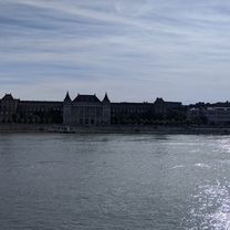
Photo after 11.1 km
\"")
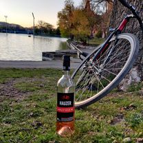
Photo after 13.3 km
Continue with Bikemap
Use, edit, or download this cycling route
You would like to ride Budakalász (Lupa átkelő) or customize it for your own trip? Here is what you can do with this Bikemap route:
Free features
- Save this route as favorite or in collections
- Copy & plan your own version of this route
- Sync your route with Garmin or Wahoo
Premium features
Free trial for 3 days, or one-time payment. More about Bikemap Premium.
- Navigate this route on iOS & Android
- Export a GPX / KML file of this route
- Create your custom printout (try it for free)
- Download this route for offline navigation
Discover more Premium features.
Get Bikemap PremiumFrom our community
Other popular routes starting in Budapest XIII. kerület
 VacRoute
- Distance
- 70.1 km
- Ascent
- 207 m
- Descent
- 210 m
- Location
- Budapest XIII. kerület, Budapest, Hungary
 Budakalász (Lupa átkelő)
- Distance
- 27.1 km
- Ascent
- 33 m
- Descent
- 36 m
- Location
- Budapest XIII. kerület, Budapest, Hungary
 Kevély kör
- Distance
- 41.4 km
- Ascent
- 653 m
- Descent
- 654 m
- Location
- Budapest XIII. kerület, Budapest, Hungary
 hidak
hidak- Distance
- 26.2 km
- Ascent
- 248 m
- Descent
- 204 m
- Location
- Budapest XIII. kerület, Budapest, Hungary
 Dobobókő via Pilisszántó
- Distance
- 46.1 km
- Ascent
- 789 m
- Descent
- 201 m
- Location
- Budapest XIII. kerület, Budapest, Hungary
 Bánki tó 2.0
- Distance
- 142.6 km
- Ascent
- 546 m
- Descent
- 543 m
- Location
- Budapest XIII. kerület, Budapest, Hungary
 Fáy utca & Városliget
- Distance
- 9.8 km
- Ascent
- 22 m
- Descent
- 23 m
- Location
- Budapest XIII. kerület, Budapest, Hungary
 From Budapest to Vác Kompkötő sziget
- Distance
- 38 km
- Ascent
- 170 m
- Descent
- 175 m
- Location
- Budapest XIII. kerület, Budapest, Hungary
Open it in the app