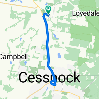
85 Lovedale Road, Lovedale to 29–37 King Road, Mount View
- 16.7 km
- 410 m
- 231 m
- Cessnock, New South Wales, Australia
A cycling route starting in Cessnock, New South Wales, Australia.
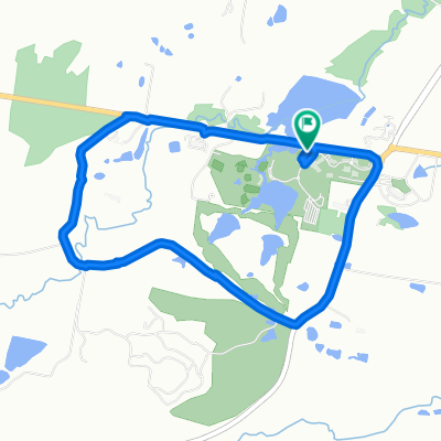
Overview
Large sections of this route are either gravel road or sandy / rocky fire trail. A mountainbike is required.
The first half is the most picturesque and the most hilly. It travels through green rolling hills and wineries The return leg is through the sandy scrub of "powerline road" and the towns of Ellalong and Paxton.
This ride took me 4 hours to complete.
created this 16 years ago
Route highlights
The next section is very sandy
Don't get lost here. If in doubt, follow the powerline
Continue with Bikemap
You would like to ride Millfield to Cessnock loop or customize it for your own trip? Here is what you can do with this Bikemap route:
Free trial for 3 days, or one-time payment. More about Bikemap Premium.
Discover more Premium features.
Get Bikemap PremiumFrom our community
Open it in the app