

Balatoni Biciklitúra - 6. nap
A cycling route starting in Pannonhalma, Győr-Moson-Sopron, Hungary.
Overview
About this route
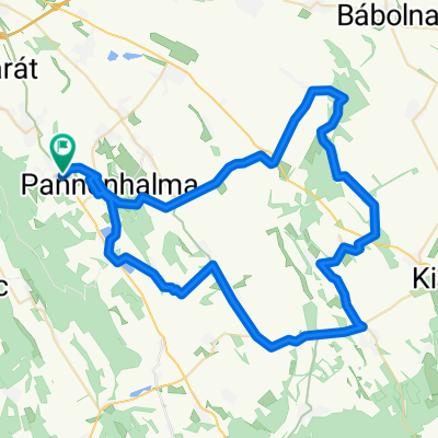
Pannonhalma, Pázmányfalu, Győr.
Győrben sok bicikliút van, az 1-es útra kell kijutni.
1-es út mellett elvileg végig van bicikli út vagy valami (merretekerjek.hu alapján).
Gönyü, (letérünk az 1es útról), Nagyszentjános, Ács, Komárom.
Szőny, Almásfüzítő, 10-es út, Dunaalmás, Neszmély, Süttő, Piszke, Lábatlan, Nyergesújfalu. Innentől megint bicikliút Tátig majd Esztergom
Esztergomnál át a Dunán, Párkány, Kamenica nad Hronom, Salka - Letkésnél vissza
Letkésen balra: Vámosmikola, Kemence, Bencebaráti, Hont, Drégelypalánk, Ipolyvece, Dejtár, Ipolyszög, Balassagyarmat, Mohora, Terény
- -:--
- Duration
- 208.3 km
- Distance
- 318 m
- Ascent
- 317 m
- Descent
- ---
- Avg. speed
- ---
- Max. altitude

Route quality
Waytypes & surfaces along the route
Waytypes
Busy road
79 km
(38 %)
Cycleway
41.8 km
(20 %)
Surfaces
Paved
122.1 km
(59 %)
Unpaved
7.2 km
(3 %)
Asphalt
116 km
(56 %)
Ground
5.6 km
(3 %)
Continue with Bikemap
Use, edit, or download this cycling route
You would like to ride Balatoni Biciklitúra - 6. nap or customize it for your own trip? Here is what you can do with this Bikemap route:
Free features
- Save this route as favorite or in collections
- Copy & plan your own version of this route
- Split it into stages to create a multi-day tour
- Sync your route with Garmin or Wahoo
Premium features
Free trial for 3 days, or one-time payment. More about Bikemap Premium.
- Navigate this route on iOS & Android
- Export a GPX / KML file of this route
- Create your custom printout (try it for free)
- Download this route for offline navigation
Discover more Premium features.
Get Bikemap PremiumFrom our community
Other popular routes starting in Pannonhalma
 ravazdi roka 55
- Distance
- 52.1 km
- Ascent
- 550 m
- Descent
- 546 m
- Location
- Pannonhalma, Győr-Moson-Sopron, Hungary
 Ravazd - Tényő - Ravazd
- Distance
- 46.2 km
- Ascent
- 353 m
- Descent
- 355 m
- Location
- Pannonhalma, Győr-Moson-Sopron, Hungary
 Pannonhalma - Kapuvár
- Distance
- 90.2 km
- Ascent
- 34 m
- Descent
- 114 m
- Location
- Pannonhalma, Győr-Moson-Sopron, Hungary
 Győr-Veszprém-Teskánd
- Distance
- 174.3 km
- Ascent
- 1,149 m
- Descent
- 1,138 m
- Location
- Pannonhalma, Győr-Moson-Sopron, Hungary
 73km_750m_PHalma-Csesznek-Zirc-Eplény
- Distance
- 73.3 km
- Ascent
- 680 m
- Descent
- 639 m
- Location
- Pannonhalma, Győr-Moson-Sopron, Hungary
 Laza karika
- Distance
- 72.1 km
- Ascent
- 245 m
- Descent
- 248 m
- Location
- Pannonhalma, Győr-Moson-Sopron, Hungary
 Balatoni Biciklitúra - 6. nap
- Distance
- 208.3 km
- Ascent
- 318 m
- Descent
- 317 m
- Location
- Pannonhalma, Győr-Moson-Sopron, Hungary
 Pannonhalma – Győr
- Distance
- 27.2 km
- Ascent
- 24 m
- Descent
- 172 m
- Location
- Pannonhalma, Győr-Moson-Sopron, Hungary
Open it in the app