
Etapa 13 (Sopó - Tunja)
A cycling route starting in Sopó, Cundinamarca, Colombia.
Overview
About this route
Day 14 – Vuelta a Colombia 2016
Sunday, June 26
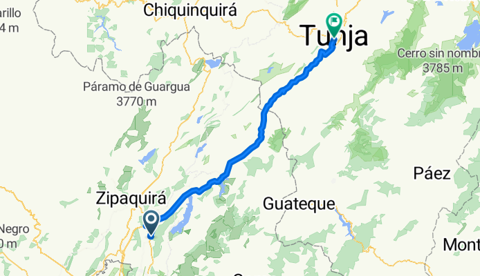
Sopó – Tocancipá – Chocontá – Villapinzón - V/quemada - Tunja and national championships circuit (four laps).
170 kms
Start time: 9 am
Arrival time: 2:00 pm
Start location: Main Park of Sopó
Arrival location: Plaza de Bolívar in Tunja
- -:--
- Duration
- 114.1 km
- Distance
- 1,092 m
- Ascent
- 883 m
- Descent
- ---
- Avg. speed
- ---
- Max. altitude
Continue with Bikemap
Use, edit, or download this cycling route
You would like to ride Etapa 13 (Sopó - Tunja) or customize it for your own trip? Here is what you can do with this Bikemap route:
Free features
- Save this route as favorite or in collections
- Copy & plan your own version of this route
- Split it into stages to create a multi-day tour
- Sync your route with Garmin or Wahoo
Premium features
Free trial for 3 days, or one-time payment. More about Bikemap Premium.
- Navigate this route on iOS & Android
- Export a GPX / KML file of this route
- Create your custom printout (try it for free)
- Download this route for offline navigation
Discover more Premium features.
Get Bikemap PremiumFrom our community
Other popular routes starting in Sopó
 Etapa 13 (Sopó - Tunja)
- Distance
- 114.1 km
- Ascent
- 1,092 m
- Descent
- 883 m
- Location
- Sopó, Cundinamarca, Colombia
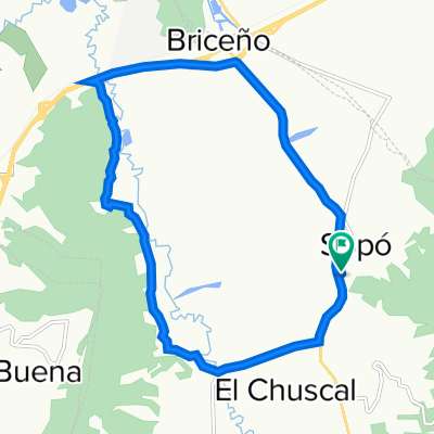
 vuelta a la sabana
- Distance
- 54.1 km
- Ascent
- 843 m
- Descent
- 851 m
- Location
- Sopó, Cundinamarca, Colombia
 De Carrera 3 2 - 83, Sopo a Avenida Boyacá 64a29, Bogotá
- Distance
- 41.9 km
- Ascent
- 102 m
- Descent
- 148 m
- Location
- Sopó, Cundinamarca, Colombia
 Lengthy bike tour through Sopó
- Distance
- 44.4 km
- Ascent
- 257 m
- Descent
- 261 m
- Location
- Sopó, Cundinamarca, Colombia
 Long ride through Guasca
- Distance
- 37.8 km
- Ascent
- 590 m
- Descent
- 589 m
- Location
- Sopó, Cundinamarca, Colombia
 Sopo - Guatavita - Sesquile
- Distance
- 46.1 km
- Ascent
- 407 m
- Descent
- 379 m
- Location
- Sopó, Cundinamarca, Colombia
 rutica diaria
- Distance
- 18.1 km
- Ascent
- 135 m
- Descent
- 139 m
- Location
- Sopó, Cundinamarca, Colombia
 rutica diaria!!!🔥
- Distance
- 18 km
- Ascent
- 103 m
- Descent
- 93 m
- Location
- Sopó, Cundinamarca, Colombia
Open it in the app