

etape 2016 Etape 6 V2
A cycling route starting in Ceaucé, Normandy, France.
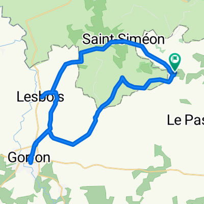
Overview
About this route
- -:--
- Duration
- 65.6 km
- Distance
- 254 m
- Ascent
- 379 m
- Descent
- ---
- Avg. speed
- ---
- Max. altitude
Route quality
Waytypes & surfaces along the route
Waytypes
Path
47.6 km
(73 %)
Quiet road
6.8 km
(10 %)
Surfaces
Paved
7.8 km
(12 %)
Unpaved
45.7 km
(70 %)
Gravel
45.7 km
(70 %)
Asphalt
6.8 km
(10 %)
Continue with Bikemap
Use, edit, or download this cycling route
You would like to ride etape 2016 Etape 6 V2 or customize it for your own trip? Here is what you can do with this Bikemap route:
Free features
- Save this route as favorite or in collections
- Copy & plan your own version of this route
- Sync your route with Garmin or Wahoo
Premium features
Free trial for 3 days, or one-time payment. More about Bikemap Premium.
- Navigate this route on iOS & Android
- Export a GPX / KML file of this route
- Create your custom printout (try it for free)
- Download this route for offline navigation
Discover more Premium features.
Get Bikemap PremiumFrom our community
Other popular routes starting in Ceaucé
 Ceaucé à 18 Rue des Fossés Plisson, Domfront en Poiraie
- Distance
- 16.2 km
- Ascent
- 1,525 m
- Descent
- 1,684 m
- Location
- Ceaucé, Normandy, France
 8 Rue de Bretagne, Soucé to 17 Rue de la Vicomte, Argentan
- Distance
- 73.5 km
- Ascent
- 626 m
- Descent
- 611 m
- Location
- Ceaucé, Normandy, France
 De Froulay 11, Couesmes-Vaucé à Le Jardin Vezins, Isigny-le-Buat
- Distance
- 64.7 km
- Ascent
- 439 m
- Descent
- 444 m
- Location
- Ceaucé, Normandy, France
 477 Les Bouillons, Saint-Fraimbault à 148 La Bonelière, Saint-Mars-d'Égrenne
- Distance
- 12.9 km
- Ascent
- 72 m
- Descent
- 91 m
- Location
- Ceaucé, Normandy, France
 De Le Petit Moulin à Le Petit Moulin
- Distance
- 26.9 km
- Ascent
- 235 m
- Descent
- 235 m
- Location
- Ceaucé, Normandy, France
 Etape4 (jeudi 9 juin): de Soucé à Mortrain
- Distance
- 47.8 km
- Ascent
- 295 m
- Descent
- 203 m
- Location
- Ceaucé, Normandy, France
 Etape 2 - Périple au mont saint michel
- Distance
- 65.3 km
- Ascent
- 174 m
- Descent
- 293 m
- Location
- Ceaucé, Normandy, France
 8 Rue de Bretagne, Soucé to 1 Rue Fontaine, Argentan
- Distance
- 74 km
- Ascent
- 631 m
- Descent
- 615 m
- Location
- Ceaucé, Normandy, France
Open it in the app