

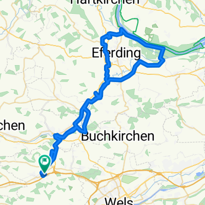
Krenglbach Rennradrunde
A cycling route starting in Bad Schallerbach, Upper Austria, Austria.
Overview
About this route
Krenglbach-Geisensheim-Gallspach-Meggenhofen-Offenhausen-Pennewang-Gunskirchen-Wels-Krenglbach
- -:--
- Duration
- 48.2 km
- Distance
- 399 m
- Ascent
- 390 m
- Descent
- ---
- Avg. speed
- 428 m
- Max. altitude
Route quality
Waytypes & surfaces along the route
Waytypes
Busy road
24.2 km
(50 %)
Road
15.2 km
(32 %)
Surfaces
Paved
24 km
(50 %)
Asphalt
23.9 km
(50 %)
Paved (undefined)
0.1 km
(<1 %)
Undefined
24.2 km
(50 %)
Continue with Bikemap
Use, edit, or download this cycling route
You would like to ride Krenglbach Rennradrunde or customize it for your own trip? Here is what you can do with this Bikemap route:
Free features
- Save this route as favorite or in collections
- Copy & plan your own version of this route
- Sync your route with Garmin or Wahoo
Premium features
Free trial for 3 days, or one-time payment. More about Bikemap Premium.
- Navigate this route on iOS & Android
- Export a GPX / KML file of this route
- Create your custom printout (try it for free)
- Download this route for offline navigation
Discover more Premium features.
Get Bikemap PremiumFrom our community
Other popular routes starting in Bad Schallerbach
 OBK 250402 Spargelzeit
- Distance
- 62 km
- Ascent
- 219 m
- Descent
- 224 m
- Location
- Bad Schallerbach, Upper Austria, Austria
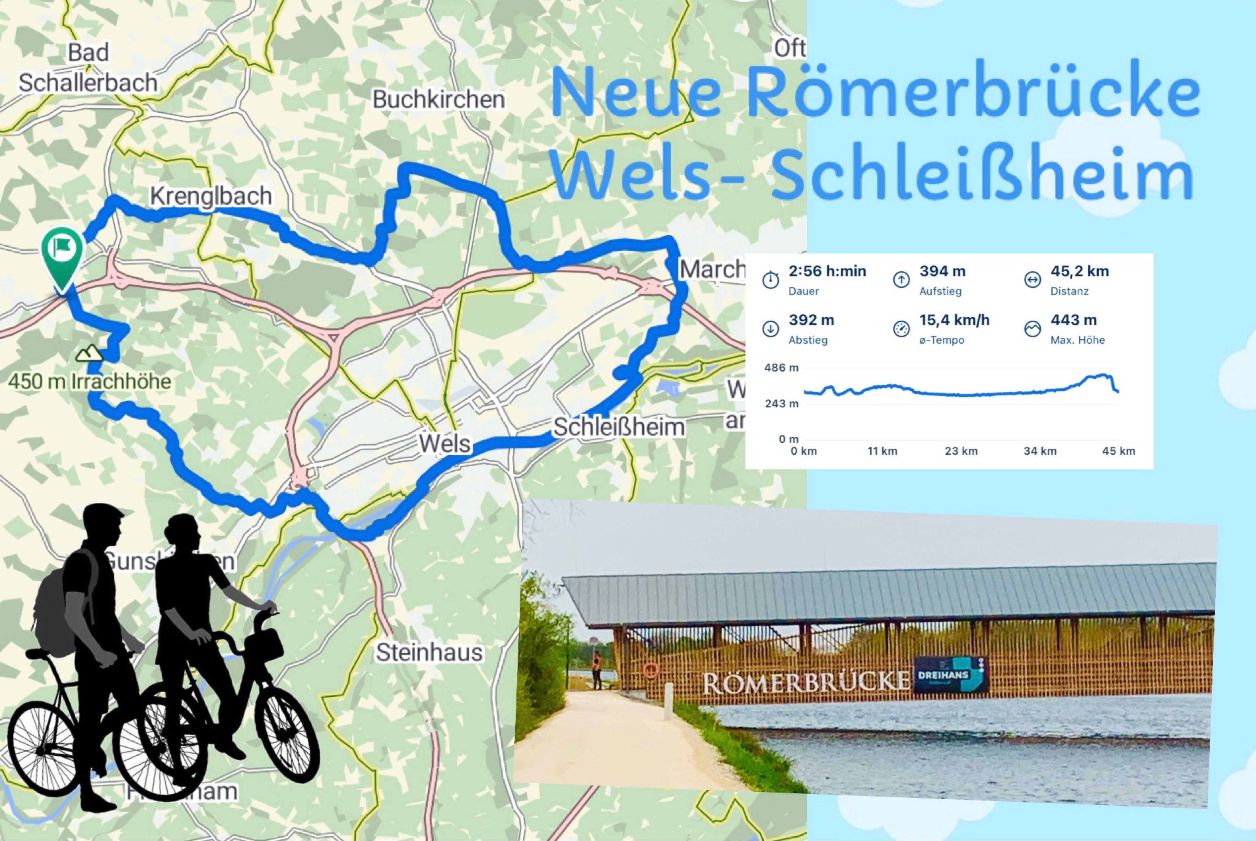 OBK 250417 RÖMERBRÜCKE
- Distance
- 45.2 km
- Ascent
- 394 m
- Descent
- 392 m
- Location
- Bad Schallerbach, Upper Austria, Austria
 2014 - Pichl / Inzing (400km / 4400Hm)
- Distance
- 392.8 km
- Ascent
- 3,329 m
- Descent
- 3,096 m
- Location
- Bad Schallerbach, Upper Austria, Austria
 OBK 250402 Spargelzeit
- Distance
- 62 km
- Ascent
- 219 m
- Descent
- 224 m
- Location
- Bad Schallerbach, Upper Austria, Austria
 OBK KALKI/Albenedt
- Distance
- 31.2 km
- Ascent
- 376 m
- Descent
- 247 m
- Location
- Bad Schallerbach, Upper Austria, Austria
 Vorschlag 1. Mai
- Distance
- 17.4 km
- Ascent
- 221 m
- Descent
- 222 m
- Location
- Bad Schallerbach, Upper Austria, Austria
 Krenglbach - St. Agatha - Haibach - Scharten
- Distance
- 83.2 km
- Ascent
- 892 m
- Descent
- 897 m
- Location
- Bad Schallerbach, Upper Austria, Austria
 Krenglbach - Gunskirchen - Traun - Pasching (PlusCity) - Krenglbach
- Distance
- 69.2 km
- Ascent
- 214 m
- Descent
- 211 m
- Location
- Bad Schallerbach, Upper Austria, Austria
Open it in the app