

Alpe-Adria
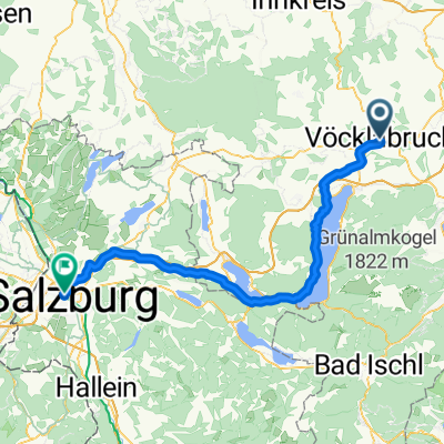
A cycling route starting in Vöcklabruck, Upper Austria, Austria.
Overview
About this route
1st camp - Inselcamp 50km
2nd camp - Sonnenterrassen-camping St. Veit 140 km
3rd camp - Pub Gestein 170km
4th camp - Strandcamping Winkler 220 km
Campingbad Ossiacher See
Ai Pioppi camp - 350
Belvedere Pineta Camping Village
- -:--
- Duration
- 489.5 km
- Distance
- 2,889 m
- Ascent
- 3,313 m
- Descent
- ---
- Avg. speed
- ---
- Max. altitude
Route highlights
Points of interest along the route
Point of interest after 38 km
1st camp
Point of interest after 141.9 km
2nd camp
Point of interest after 173.3 km
3rd Camp
Point of interest after 212.9 km
Ionos Camping
Point of interest after 236.1 km
Strandcamping Winkler
Point of interest after 278.9 km
Campingbad Ossiacher See
Point of interest after 387.9 km
Ai Pioppi camp
Point of interest after 483.4 km
Belvedere Pineta Camping Village
Continue with Bikemap
Use, edit, or download this cycling route
You would like to ride Alpe-Adria or customize it for your own trip? Here is what you can do with this Bikemap route:
Free features
- Save this route as favorite or in collections
- Copy & plan your own version of this route
- Split it into stages to create a multi-day tour
- Sync your route with Garmin or Wahoo
Premium features
Free trial for 3 days, or one-time payment. More about Bikemap Premium.
- Navigate this route on iOS & Android
- Export a GPX / KML file of this route
- Create your custom printout (try it for free)
- Download this route for offline navigation
Discover more Premium features.
Get Bikemap PremiumFrom our community
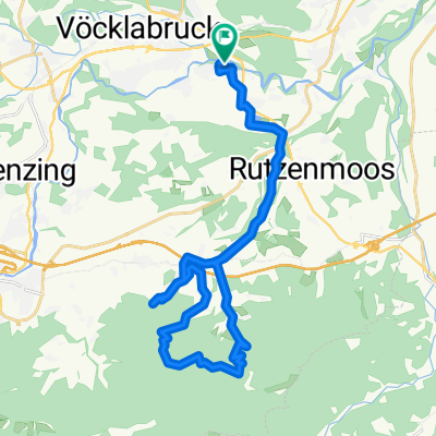
Other popular routes starting in Vöcklabruck
 Vöcklabruck - Lichtenberg
- Distance
- 66.3 km
- Ascent
- 829 m
- Descent
- 808 m
- Location
- Vöcklabruck, Upper Austria, Austria
 Großalmrunde
- Distance
- 63.3 km
- Ascent
- 602 m
- Descent
- 602 m
- Location
- Vöcklabruck, Upper Austria, Austria
 VB-Hongar-Retour
- Distance
- 24.8 km
- Ascent
- 682 m
- Descent
- 636 m
- Location
- Vöcklabruck, Upper Austria, Austria
 Moderate Route in Wufing
- Distance
- 21.5 km
- Ascent
- 319 m
- Descent
- 247 m
- Location
- Vöcklabruck, Upper Austria, Austria
 regau Hongar
- Distance
- 39.1 km
- Ascent
- 904 m
- Descent
- 905 m
- Location
- Vöcklabruck, Upper Austria, Austria
 Salzburg
- Distance
- 76.9 km
- Ascent
- 442 m
- Descent
- 440 m
- Location
- Vöcklabruck, Upper Austria, Austria
 Vöcklabruck - Lambach über Wolfshütte
- Distance
- 54.9 km
- Ascent
- 465 m
- Descent
- 472 m
- Location
- Vöcklabruck, Upper Austria, Austria
 Lange Ausfahrt durch Regau nach Aurach
- Distance
- 30.9 km
- Ascent
- 495 m
- Descent
- 495 m
- Location
- Vöcklabruck, Upper Austria, Austria
Open it in the app