

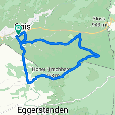
E6: GAIS Bahnhof - ABTWIL Säntispark
A cycling route starting in Gais, Canton of Appenzell Ausserrhoden, Switzerland.
Overview
About this route
- -:--
- Duration
- 26 km
- Distance
- 405 m
- Ascent
- 682 m
- Descent
- ---
- Avg. speed
- ---
- Max. altitude
Route quality
Waytypes & surfaces along the route
Waytypes
Quiet road
11.5 km
(44 %)
Road
6.9 km
(27 %)
Surfaces
Paved
21.3 km
(82 %)
Unpaved
2.5 km
(10 %)
Asphalt
20.7 km
(80 %)
Gravel
1.2 km
(4 %)
Continue with Bikemap
Use, edit, or download this cycling route
You would like to ride E6: GAIS Bahnhof - ABTWIL Säntispark or customize it for your own trip? Here is what you can do with this Bikemap route:
Free features
- Save this route as favorite or in collections
- Copy & plan your own version of this route
- Sync your route with Garmin or Wahoo
Premium features
Free trial for 3 days, or one-time payment. More about Bikemap Premium.
- Navigate this route on iOS & Android
- Export a GPX / KML file of this route
- Create your custom printout (try it for free)
- Download this route for offline navigation
Discover more Premium features.
Get Bikemap PremiumFrom our community
Other popular routes starting in Gais
 Haustrainingsrunde
- Distance
- 10.4 km
- Ascent
- 335 m
- Descent
- 333 m
- Location
- Gais, Canton of Appenzell Ausserrhoden, Switzerland
 A - Route 2 - Gäbris 36 km
- Distance
- 35.6 km
- Ascent
- 713 m
- Descent
- 703 m
- Location
- Gais, Canton of Appenzell Ausserrhoden, Switzerland
 Eggerstanden - Kamor - Bollenwees - Appenzell
- Distance
- 38.9 km
- Ascent
- 1,192 m
- Descent
- 1,300 m
- Location
- Gais, Canton of Appenzell Ausserrhoden, Switzerland
 Hohe Hirschbergstrasse 58, Appenzell Meistersrüte nach Marktgasse 4, Altstätten
- Distance
- 15.1 km
- Ascent
- 101 m
- Descent
- 779 m
- Location
- Gais, Canton of Appenzell Ausserrhoden, Switzerland
 vac j5
- Distance
- 54.2 km
- Ascent
- 1,171 m
- Descent
- 1,344 m
- Location
- Gais, Canton of Appenzell Ausserrhoden, Switzerland
 Gais (AR) - Appenzell (AI) - St. Gallen (SG)
- Distance
- 23.6 km
- Ascent
- 317 m
- Descent
- 579 m
- Location
- Gais, Canton of Appenzell Ausserrhoden, Switzerland
 Von Gais bis Zürich
- Distance
- 91 km
- Ascent
- 1,080 m
- Descent
- 1,580 m
- Location
- Gais, Canton of Appenzell Ausserrhoden, Switzerland
 Samstagstour 2. Teil
- Distance
- 25.3 km
- Ascent
- 323 m
- Descent
- 402 m
- Location
- Gais, Canton of Appenzell Ausserrhoden, Switzerland
Open it in the app