

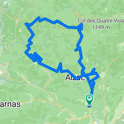
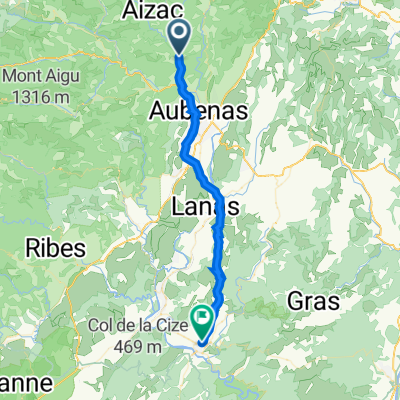
dag3a
A cycling route starting in Vals-les-Bains, Auvergne-Rhône-Alpes, France.
Overview
About this route
- -:--
- Duration
- 110.7 km
- Distance
- 1,085 m
- Ascent
- 1,097 m
- Descent
- ---
- Avg. speed
- ---
- Max. altitude
Route quality
Waytypes & surfaces along the route
Waytypes
Road
39.9 km
(36 %)
Quiet road
28.8 km
(26 %)
Surfaces
Paved
55.4 km
(50 %)
Unpaved
5.5 km
(5 %)
Asphalt
55.4 km
(50 %)
Gravel
4.4 km
(4 %)
Continue with Bikemap
Use, edit, or download this cycling route
You would like to ride dag3a or customize it for your own trip? Here is what you can do with this Bikemap route:
Free features
- Save this route as favorite or in collections
- Copy & plan your own version of this route
- Split it into stages to create a multi-day tour
- Sync your route with Garmin or Wahoo
Premium features
Free trial for 3 days, or one-time payment. More about Bikemap Premium.
- Navigate this route on iOS & Android
- Export a GPX / KML file of this route
- Create your custom printout (try it for free)
- Download this route for offline navigation
Discover more Premium features.
Get Bikemap PremiumFrom our community
Other popular routes starting in Vals-les-Bains
 Autour de Vals les Bains
- Distance
- 76.4 km
- Ascent
- 1,271 m
- Descent
- 1,271 m
- Location
- Vals-les-Bains, Auvergne-Rhône-Alpes, France
 Antraigues-sur-Volane, Château de Crau
- Distance
- 37.5 km
- Ascent
- 798 m
- Descent
- 794 m
- Location
- Vals-les-Bains, Auvergne-Rhône-Alpes, France
 Boucle des 3 vallées
- Distance
- 70.3 km
- Ascent
- 1,349 m
- Descent
- 1,345 m
- Location
- Vals-les-Bains, Auvergne-Rhône-Alpes, France
 Di 16.8. Von den Montagne Ardechoise in die Cevennen
- Distance
- 143.4 km
- Ascent
- 3,159 m
- Descent
- 3,221 m
- Location
- Vals-les-Bains, Auvergne-Rhône-Alpes, France
 Montagnes et volcans d'Ardèche
- Distance
- 90.6 km
- Ascent
- 1,701 m
- Descent
- 1,700 m
- Location
- Vals-les-Bains, Auvergne-Rhône-Alpes, France
 Route pont de Labeaume
- Distance
- 27.1 km
- Ascent
- 620 m
- Descent
- 620 m
- Location
- Vals-les-Bains, Auvergne-Rhône-Alpes, France
 Ardeche 4 - 2/05
- Distance
- 34.8 km
- Ascent
- 414 m
- Descent
- 570 m
- Location
- Vals-les-Bains, Auvergne-Rhône-Alpes, France
 dx_63km
- Distance
- 62.8 km
- Ascent
- 1,133 m
- Descent
- 1,155 m
- Location
- Vals-les-Bains, Auvergne-Rhône-Alpes, France
Open it in the app