

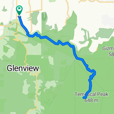
Santa Monica Hills Ride
A cycling route starting in Woodland Hills, California, United States.
Overview
About this route
- -:--
- Duration
- 69.1 km
- Distance
- 985 m
- Ascent
- 1,000 m
- Descent
- ---
- Avg. speed
- 468 m
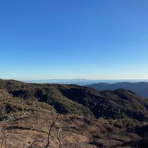
- Max. altitude
Route quality
Waytypes & surfaces along the route
Waytypes
Quiet road
26.3 km
(38 %)
Cycleway
5.5 km
(8 %)
Surfaces
Paved
47 km
(68 %)
Asphalt
41.5 km
(60 %)
Concrete
4.1 km
(6 %)
Continue with Bikemap
Use, edit, or download this cycling route
You would like to ride Santa Monica Hills Ride or customize it for your own trip? Here is what you can do with this Bikemap route:
Free features
- Save this route as favorite or in collections
- Copy & plan your own version of this route
- Sync your route with Garmin or Wahoo
Premium features
Free trial for 3 days, or one-time payment. More about Bikemap Premium.
- Navigate this route on iOS & Android
- Export a GPX / KML file of this route
- Create your custom printout (try it for free)
- Download this route for offline navigation
Discover more Premium features.
Get Bikemap PremiumFrom our community
Other popular routes starting in Woodland Hills
 Don Pio Dr, Los Angeles to Don Pio Dr, Los Angeles
- Distance
- 21.7 km
- Ascent
- 539 m
- Descent
- 544 m
- Location
- Woodland Hills, California, United States
 Topanga Canyons Route
- Distance
- 30.1 km
- Ascent
- 454 m
- Descent
- 454 m
- Location
- Woodland Hills, California, United States
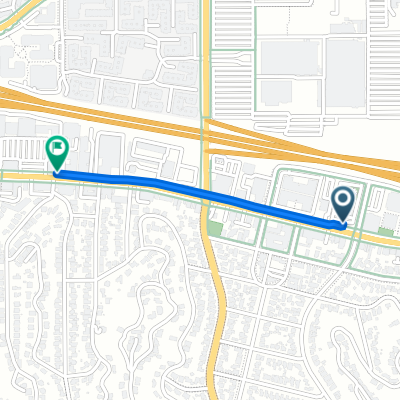 21101 Ventura Blvd, Los Angeles to 21733 Ventura Blvd, Los Angeles
- Distance
- 0.8 km
- Ascent
- 0 m
- Descent
- 3 m
- Location
- Woodland Hills, California, United States
 Santa Monica Hills Ride
- Distance
- 69.1 km
- Ascent
- 985 m
- Descent
- 1,000 m
- Location
- Woodland Hills, California, United States
 Marylee Street 25, Los Angeles to Marylee Street 221, Los Angeles
- Distance
- 30.9 km
- Ascent
- 443 m
- Descent
- 442 m
- Location
- Woodland Hills, California, United States
 Catalina view from Backbone Trail, Los Angeles
- Distance
- 10.9 km
- Ascent
- 483 m
- Descent
- 172 m
- Location
- Woodland Hills, California, United States
 SMMTC_Kickoff
- Distance
- 146.5 km
- Ascent
- 2,422 m
- Descent
- 2,422 m
- Location
- Woodland Hills, California, United States
 21733 Ventura Blvd, Los Angeles to 501–559 Laguna Rd, Camarillo
- Distance
- 55.3 km
- Ascent
- 1,092 m
- Descent
- 1,352 m
- Location
- Woodland Hills, California, United States
Open it in the app