

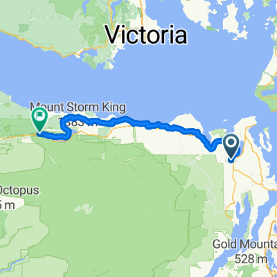
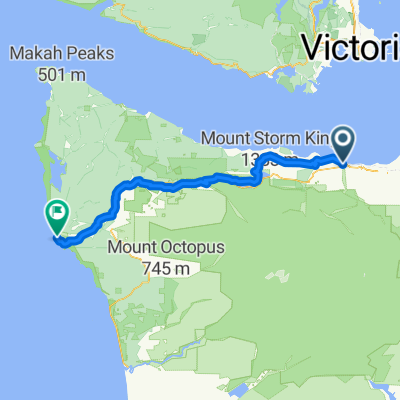
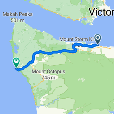
National Parks tour
A cycling route starting in Port Angeles, Washington, United States.
Overview
About this route
- -:--
- Duration
- 5,325.1 km
- Distance
- 10,359 m
- Ascent
- 9,109 m
- Descent
- ---
- Avg. speed
- ---
- Max. altitude
Route highlights
Points of interest along the route
Point of interest after 1,012.5 km
Crater lake NP
Point of interest after 1,584.4 km
Redwood NP
Point of interest after 1,964.6 km
Lassen Volcanic NP
Point of interest after 2,276 km
Channel Islands NP
Point of interest after 2,276 km
Yosemite NP
Point of interest after 2,397.5 km
Sequoia NP
Point of interest after 2,397.5 km
Kings Canyon NP
Point of interest after 2,563.8 km
Death Valley NP
Point of interest after 2,867.7 km
Great Basic NP
Point of interest after 3,163 km
Glacier NP
Point of interest after 3,170.1 km
Grand Teton NP
Point of interest after 3,170.1 km
Yellowstone NP
Point of interest after 3,466.6 km
Arches NP
Point of interest after 3,751.7 km
Black Canyon of the Gunnison NP
Point of interest after 3,881.1 km
Rocky Mountain NP
Point of interest after 3,881.1 km
Wind Cave NP
Point of interest after 3,881.1 km
Theodore Roosevelt NP?
Point of interest after 3,978.5 km
Badlands NP
Point of interest after 4,061.9 km
Carlsbad Caverns NP
Point of interest after 4,061.9 km
Big Bend NP
Point of interest after 4,062.7 km
Abaco NP
Point of interest after 4,062.7 km
Dry Tortugas NP
Point of interest after 4,062.7 km
Everglades NP
Point of interest after 4,062.7 km
Hot Springs NP
Point of interest after 4,062.7 km
Great Smoky Mountains NP
Point of interest after 4,062.7 km
Congaree NP?
Point of interest after 4,067 km
Shenandoah NP
Point of interest after 4,067 km
Isle Royale NP
Point of interest after 4,067 km
Cuyahog Valley NP
Point of interest after 4,067 km
Mammoth cave NP
Point of interest after 4,067 km
Voyageurs NP
Point of interest after 4,067 km
Acadia NP
Point of interest after 4,067 km
Great Sand Dunes NP
Point of interest after 4,235.4 km
Guadalupe Mountains NP
Point of interest after 4,408.3 km
Mesa Verde NP
Point of interest after 4,623.2 km
Canyonlands NP
Point of interest after 4,763.3 km
Petrified Forest NP
Point of interest after 5,008.1 km
Capitol Reef NP
Point of interest after 5,278.9 km
Saguaro NP
Point of interest after 5,278.9 km
Grand Canyon NP
Point of interest after 5,316.3 km
Joshua Tree NP
Point of interest after 5,320.2 km
Zion NP
Continue with Bikemap
Use, edit, or download this cycling route
You would like to ride National Parks tour or customize it for your own trip? Here is what you can do with this Bikemap route:
Free features
- Save this route as favorite or in collections
- Copy & plan your own version of this route
- Split it into stages to create a multi-day tour
- Sync your route with Garmin or Wahoo
Premium features
Free trial for 3 days, or one-time payment. More about Bikemap Premium.
- Navigate this route on iOS & Android
- Export a GPX / KML file of this route
- Create your custom printout (try it for free)
- Download this route for offline navigation
Discover more Premium features.
Get Bikemap PremiumFrom our community
Other popular routes starting in Port Angeles
 Day 03: Port Angeles to La Conner
- Distance
- 158.4 km
- Ascent
- 763 m
- Descent
- 767 m
- Location
- Port Angeles, Washington, United States
 Day 03: Port Angeles to La Conner
- Distance
- 158.2 km
- Ascent
- 1,097 m
- Descent
- 1,077 m
- Location
- Port Angeles, Washington, United States
 Metric Century 1st Leg Alt route (less climbing)
- Distance
- 16.5 km
- Ascent
- 256 m
- Descent
- 197 m
- Location
- Port Angeles, Washington, United States
 East Railroad Avenue to East Railroad Avenue
- Distance
- 34.5 km
- Ascent
- 293 m
- Descent
- 264 m
- Location
- Port Angeles, Washington, United States
 mercredi
- Distance
- 122.5 km
- Ascent
- 2,256 m
- Descent
- 1,938 m
- Location
- Port Angeles, Washington, United States
 National Parks tour
- Distance
- 5,325.1 km
- Ascent
- 10,359 m
- Descent
- 9,109 m
- Location
- Port Angeles, Washington, United States
 la push - port Angeles
- Distance
- 124.6 km
- Ascent
- 2,234 m
- Descent
- 2,258 m
- Location
- Port Angeles, Washington, United States
 Olympic discovery path 2
- Distance
- 125.9 km
- Ascent
- 2,170 m
- Descent
- 2,233 m
- Location
- Port Angeles, Washington, United States
Open it in the app